Updated: 27th October 2010, 16.20 p.m.

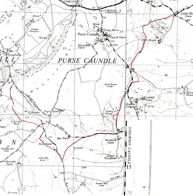
Something of a panoramic view of the Purse Caundle vale, as seen from Rue Lane, O.S. Grid ref: ST 693 156. Hanover Wood is on the extreme top left-hand side, and Wood House Covert on the right-hand side. Along the distant skyline is the Purse Caundle northernmost section of the Dorset-Somerset boundary.
- - - - -- - - - - - - - - - - -
'This fertile and sheltered tract of country in which the fields are never brown and the springs never dry.' Thomas Hardy
Other similar sentiments expressed have been:
'. . . the beautiful Vale of Blackmore, an engirdled and secluded region.'
'. . . the prospect is a broad rich mass of grass and trees, mantling minor hills and dales within the major.'
The parish of Purse Caundle is in the far north-west of Dorset, just on the northern edge of Blackmore Vale, being within a little vale of its own. It is bounded on three sides (west, north and north-east) by the county of Somerset, being almost midway between Milborne Port to the west and Henstridge to the north-east, which are both in Somerset. Further to the west is Sherborne (Dorset) some four miles distant, and Stalbridge (Dorset) some 3 miles eastwards; whilst southwards are Stourton Caundle and Bishops Caundle.
The parish lies in the broad valley of a small tributary of the River Yeo - the Caundle Brook.The land rises from about the 70 ft above sea-level in the area of the church to just over 350 ft in the north-west, and in both the south-east and north-east to about 450 ft. The village itself lies roughly near the centre of the parish, and appears to have grown up arpund the stream there.
In 1874, when the official Ordnance Survey parish boundary perambulation was undertaken, the acreage was stated as being 1,470, with a circumference of 1 1/4 miles.
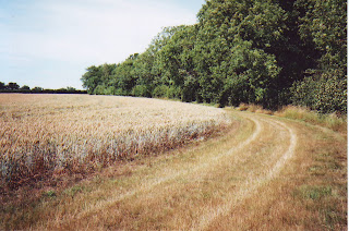
The present parish, covering some 1,588 acres, straddles the 18th century London-Exeter turnpike A30 road, though only Raghill cottages and the later built hamlet of Crendle with some fields and woodland lie on the north side of this road. The main somewhat compact part of the village lies 1/4 mile south of the road, with two old outlying farms and two houses southwards.
There have been several full and partial Dorset county maps which have depicted Purse Caundle (in various spellings). Firstly, there is Gough's somewhat primitive map of Britain, c.1300, with un-named towns just depicted as black spots. Then c.1570 was the map of north-west Dorset (British Library ref: Add. Mss 52522) which showed 'Mr Hatton' as Lord of Purse Caundle (which is confirmed in APPENDIX A1). A full description and review of this map was given in 'An Elizabethan Map of North-West Dorset: Sherborne, Yetminster and Surrounding Manors' by Katherine Barker, in Maps and History in South-West England, 1991. Then came Christopher Saxton's county map in 1575 (see\detail); John Speed's in 1610; an unatributed one in 1645 (see detail); John Ogilby's road maps of 1656 (see detail); London bookseller John Wilcox's c.1732, dedicated to the 'Honourable George Dodington Esq.; Isaac Taylor's in 1765 (see detail); the Manor Estate 'Survey of Purse Caundle belonging to the Right Honble Francis Earl Brooke and Earl of Warwick' c.1780; Robert Colt Hoare's estate map of the Manor of Purse Caundle in 1785; two unatributed Manor estate maps c.1810; and the Purse Caundle Tithe Map of 1838.
Maps became more detailed with the advent of the Ordnance Survey in the early 19th century. It is interesting to compare early pre- and post-railway 1 inch maps (see details). End of 19th century 6 inch maps are naturally more detailed. In the 21st century aerial, and 3-D ground level panoramic visual images are becoming easily and freely available on the internet.
Illustrated are appropriate sections of a 1903 edition of an Ordnance Survey six-inch scale map of Purse Caundle (with acknowledgements to the Ordnance Survey). For 21st century conditions readers should refer to the Ordnance Survey Explorer 129 map - Yeovil & Sherborne.
1. - COUNTY, PARISH, AND MANOR BOUNDARIES
From information derived from the above, a boundary line around the parish/Manor can be determined - in theory and on paper that is. The difficulty is in accurately ascertaining it on the ground, and with what permanent boundary markers there may have been, and what are still in situ. The various county and parish boundaries may well have been marked out in diferent fashions, depending on such aspects as terrain, and what was already in existence that could have been utilised. The earliest boundary in this instance can be assumed to have been the county boundary between Dorset and Somerset, but unfortunately there seems to be no extant Anglo-Saxon charter, etc. setting this original joint-county boundary. It is worth noting that the first so-far known mention of 'Dorset' was in 845 (though neighbouring Hampshire was first mentioned in 757). James Campbell in The History of the English Shires wrote 'though there are reasons for supposing that [they] may be a century or more older.'The subject and history of boundaries has thankfully been well-covered by Maurice Beresford in his History on the Ground. One could be tempted into reprinting much of this verbatim in this Purse Caundle History, but must perforce only necessarily use it as it may relate to Purse Caundle. As quoted by Beresford, the use of asn old Saxon boundary charter from its inception would have been referred to in order to settle a dispute. For instance, in 896, in the Cotswolds, a claimant was ordered by the Witan:
'to ride out with the priest of the people of 'X' . . . along all the boundaries as he read them from the old books [i.e.charters].'
Not so many places have surviving documents as early as this, yet firm boundaries must have been established with thir position handed down orally from generation to generation. This would have been reinforced sometimes by perambulations of the bounds, and later in medieval times by their enrolment in manor court records.
1A - PURSE CAUNDLE'S DORSET-SOMERSET COUNTY BOUNDARY

This author had already to a certain extent perambulated most of this inter-county boundary before joining a similar exercise by the Dorset County Boundary Survey Group on 3rd June 2009. On this occasion all but the final south-west 1200 metre section was traversed. The current O.S. Explorer 129 and British Geological Survey 'Shaftesbury' maps were used, together with early large scale O.S. maps.
During 1883-1884 Ordnance Survey Royal Engineers (R.E.) staff undertook parish boundary perambulations in collaboration with the respective parishs' meresmen. Tithe maps from the 1830s were used as the basis for determining the official boundaries. Any discrepancies, differences, etc. were to be mutually agreed. The R.E. staff drew annotated sketch plans in special notebooks, which were later deposited with the National Archives under shelf-mark OS 26, with each notebook being given its own individual identification number - as will be shown below. The notations included such comments as to whether the boundary was hedge, wall or stream; and how distant from a hedge bottom was the boundary. Having noted the contents of the relevant O.S. 26 notebooks, this writer has undertaken final perambulations of all Purse Caundle bounds, taking photographs along the way. These show not only the view forward, but sometimes also views backwards.These R.E. perambulations were generally carried out in a clockwise direction, but for personal reasons this writer preferred to travel anti-clockwise.

This O.S. map section shows the first part of the perambulation, starting from the road junction at Copse House Farm and procceding in a north-westerly direction to the A30 road at Toomers Hill.


This junction is immediately opposite the end of the Purse Caundle parish boundary with Stalbridge (Weston) - as described in section 1B. The photograph above shows the view in the opposite direction of the previous one, and the start of the anti-clockwise county boundary perambulation.The boundary between Purse Caundle and Henstridge was mutually agreed with the respective Meresmen: Henry Harris and Josiah Pickford. The latter made a special declaration: 'Property Right. The owners of hedges, banks etc in the Parish of Henstridge claim six feet into adjoining land as their property and they the owners can appropriate this six feet space to any purpose they choose.'

Proceeding from the Landshire Lane junction north-westwards along the Stalbridge Weston road, for a total of some 330 yards, as per notebook OS 26/9365 (County of Somerset No. 9904 -Henstridge) pages 18-23, on the north side there is a dry-stone wall, some four feet high. The first section is now hidden by a hedge, but still visible. The road-facing side of the wall is the boundary. The stone to build this wall could well have come from a quarry a little way along Landshire Lane seen above. The corner hedge on the left is at the end of the aforementioned boundary between Purse Caundle and Stalbridge Weston.

About halfway along the wall had been breached in recent years for the building of a house.

This is the continuation of the house wall, and then resumption of the original boundary wall, again behind the hedge.

This section of wall ends at two field gates, the second of which is where the boundary then turns more northwards - ST 707182. (Only a few yards further westwards along the road, on the south side, the Ordnance Survey has erected one of their trigonometric concrete markers at height 141 metres).

This is a view from the above gateway, showing the boundary wall (initially obscured by foliage) on the right, which now continues for a total of about 1,100 yards across farmland and through coppice, with firstly a strip of coppice part of the way along the eastern (Somerset) side of the wall.

The actual boundary was preliminary recorded by O.S. as being 'Foot of Wall', with the 'Halter Path' recorded as being '15ft wide from face of wall'. But the boundary was later to be defined as '15ft Face of Wall'. The boundary proceeds straight from the road gateway for some 150 yards before turning slightly leftwards, and then a further 75 yards to a field gateway across the pathway (ST 705 184). The adjoining coppice then continues for another 120 yards, ending almost at a field gateway within the wall.

After the coppice ends, the wall continues, with a break for a field gate. About five yards past this gateway, alongside the wall on the Purse Caundle side is a large recumbent dark stone (?similar to granite), which for size and characteristics does not appear to have been part of the wall. Was this a pre-wall boundary marker? A £2 coin is used to give some indication of size - though approximate dimensions are shown on the sketch below.

 The wall continues from the above stone for some 100 yards until it reaches a gateway into a strip of woodland through which the bridleway continues, as does the wall alongside on the eastern (Somerset) side. The boundary was still being recorded as '15ft Face of Wall'.
 This is a view backwards through the woodland to the entrance gateway. This woodland could be of only recent growth, as in 1883 the Purse Caundle side of the wall at this point was recorded as being 'Firs'. This path/track is classified as a 'Green Lane'.
This early section of the pathway forward through the coppice, as can be seen, is inclined to be somewhat muddy and overgrown, with stones from the boundary wall on the right/east now being used as paving.

This is another backward glance along the woodland path, with the boundary wall clearly visible on the left (eastern) side. Because of the '15ft Face of Wall' notation, Ordnance Survey maps show the boundary as westward of the pathway - here on the right-hand side.

This is another backward view further along the path, passing by the first of two aerial mast compounds. This mast was built to resemble a tree - and which is similarly liable to shed a twig!

This is another backward glance further along the path, passing-by the second mobile phone aerial mast compound, again with the boundary wall on the left/east.

It is at this point that the wall ends at a field gateway, and where the woodland widens out eastwards to encompass an old quarry. This is a view back from the gateway along the Somerset side of the boundary wall. In 1883 the field was recorded as being 'Furze'.

From this point the boundary - being now on the brow of Toomer Hill - was recorded as 'Defaced for 300 ft(?)' by the O.S. in 1883. This may have been so caused by the early opening of the quarry for building the wall - both being in Somerset. It thus continues in the same straight line, passing to the west of the now disused quarry, (its stratafied face just visible on the extreme right of the photograph), across the A30 main road (ST 702 191, Bench Mark 452 feet), and still 'Defaced' up and over a coppice bank to the beginning of the Old Road which dates from at least medieval times.
Somewhere at this point the O.S. recorded there being 'Boundary Posts', but as they are no longer in existence, and what their exact position was it is not known, and neither whether they were erected by Dorset or Somerset County Councils. See a more positive explanation at Crundle Corner below.

This O.S. map section covers the county boundary from Toomers Hill westwards to Crendle (or Crundle) Wood.

Once onto the 'Old Road', the boundary proceeds westwards along its north side a few yards until a gateway is reached - just visible in left-hand top corner.

The boundary then turns northward through the gateway (ST 702 191) into private woodland - Brownshill Copse, where there is no public right of way. The Dorset County Boundary Survey had to request permission to perambulate through it.
 The boundary proceeds along a pathway at the foot of a wooded escarpment. In 1883 the O.S. records '6 ft Root of Hedge' on the Purse Caundle side, but no such hedging is now visible; whilst by 1928 the O.S. record says 'Top of Bank' (which would be up on the right-hand side). This is now the start of the shared boundary between Purse Caundle and Milborne Port parishes, covered in OS 26/9424 (County of Somerset No. 10935), pages 13-19, 32-34, 39 and 42. The meresmen were Henry Harris overseer for Purse Caundle, and Joseph Hyde rate collector for Milborne Port. The latter made a written 'Property Right. The Owners of Hedges, Banks &c., claim Six feet space into the adjoining lands, and they thr owners - can appropriate this space to any purpose they choose walls are however as a rule built to the extent of property.'
This is the view back southwards along the track, taken from the start of a supposed boundary ditch - see next photograph.

At ST 701 192, something of a shallow ditch starts to run off westwards from the track, seemingly along the line of the boundary, until it reaches the western open edge of the woodland at ST 698 191, though the Ordnance Survey records this section of the boundary as 'Defaced'.

This shows a continuation westwards of the boundary ditch.
 A further continuation downwards along the boundary ditch.
 Nearing the end of the boundary section of the ditch.
The end of the boundary section of the ditch at ST 701 192, as the boundary now turns up to the right (northwards) along the edge of the woodland.

This photograph shown a view at ST 701 192 backwards along the boundary ditch inside the woodland.
The boundary then turns sharply to run northwards for about 50 metres along the edge of the wood (which seemingly was not in existence in 1883, except for perhaps a very narrow boundary strip) and field until reaching a gateway back into the now woodland at ST 698 192. Again the boundary is recorded as '6 ft Root of Hedge' on the Milborne Port side inside the copse.

The boundary then runs 'Defaced' in a gentle left-hand curve across four fields to just below Gospel Ash Farm. This photograph shows the south-westerly route of the boundary line acrss the first field to near the left-hand corner where it goes through a hedge.

This is the view backwards along the 'Defaced' boundary across this first field to the woodland gate with the previous distant section along the edge of the woodland running away to the right. It would be of interest to learn the reason for these seemingly erratic boundary directions in this vicinity; but Maurice Beresford in his book, pages 44-45 was of the opinion that "bounds which make a large number of small right-angled turns and returns within a short distance . . . On the edge of a parish these small clearances will probable be the final act in the conquest of the forest, . . ."
The boundary continues to run 'Defaced' across the second field to within a few metres of the south-west corner. Here is goes those few metres south to the entrance into the third field
The boundary continues westwards along the hedgeline parallel with the Old Road, until it reaches the fourth field.
At the far western end of the fourth field the 'Defaced' boundary comes to a gateway onto and crosses the tarmaced driveway which leads to Gospel Ash farm to the north.

This is a view of the present Gospel Ash tree at ST 692 188, looking westwards from the farm driveway, and onwards along the 'Defaced' boundary route. There are two supposed explanations for this tree being so named as will be seen in CHAPTERS 5 and 7. Ash trees were often used as boundary markers, their use being derived from the Anglo-Saxon god Woden who received a message from the runes of the ash tree. An ash tree could live up to a 1,000 years, with each tree differing in its bark structure. Boundary trees would often be planted on natural or man-made mounds or banks.

After a short distance across the open field the 'Defaced' boundary then meets with a stream which flows N-S. For a few yards the boundary follows the eastern bank of the stream northwards at ST 691 189. This photographs is looking eastwards across the stream to the boundary on the opposite bank.

This photograph shows the point at which the boundary ceases to follow the stream and turns sharp left to follow a hedgeline westwards.

The boundary follows the other (northern) side of the right-hand hedgeline to the far end of the field, which O.S. records as '6ft Root of Hedge'.
At the far end of the field hedge the boundary makes a small kink northwards along the field hedgeline before continuing 'Defaced' south-westwards across a final field.
 It eventually reaches the first few metres of a Green Lane going north-westwards, at its junction with the now still original surfaced Old Road (now classed as an Occupation Road) which goes away south-westwards down to Milborne Port, and the pathway going southwards through Crendle Wood. This point is at ST 687 188, contour height 115 metres. This is the view from this point backwards along the 'Defaced' boundary across a field and eventually to Gospel Ash Farm visible in the centre background.
  There was a deal of discussion by O.S. at the time as to the correct route of the boundary at this junction. As well as the two meresmen, other interested parties were consulted by the O.S. On the westward side of the Green Lane, on top of the embankment looking down onto the Old Road to Milborne Port is this old boundary stone, which the O.S. considered to have been placed on the wrong side of the Green Lane. This view of the stone is taken from below, on the escarpment slope.
This O.S. map section follows the county boundary southwards down through Crendle Wood to Crundle Corner, Bench Mark 235.4 feet.

This photograph was taken from close to the boundary stone, looking forward across the Old Road to the boundary's entrance through a gateway into Crendle Wood.

The boundary now runs through this gateway and southwards for a total of about 900 yards down through Crendle Wood to the A30 road at Crendle Corner. Firstly it runs along the top of an escarpment which faces westwards into Somerset. The O.S. however records '6 ft Root of Hedge' along the Somerset side of this route, with woodland only this same side and not like now also on the Dorset side.

Further down through Crendle Wood, clearly showing the ditch and escarpment to the (Somerset) right-hand.

Further down still along the boundary escarpment.


Quite a way down through Crendle Wood, the track turns into a serpentine path, when the boundary then starts to run along the Somerset side of a hedgeline on the left-hand side of the woodland, through a disused quarry, then for a few meters on the Dorset side of another field's hedgeline until it meets up again with the N-S stream met with earlier up near Gospel Ash.

The boundary is defined as 'Face of Wall' of a bridge over the stream.
The boundary follows the stream down to the A30 road at Crendle Corner at ST 691 182, contour height 80 metres. It was agreed with the O.S. that the stream is wholly within Dorset, with the boundary running along its western bank.
Here at Crendle Corner rhe boundary stream runs through a culvert under the A30 road, with the boundary 'Centre of Stream', before reverting to being wholly in Dorset. Whilst not noticable in this instance, at other locations when a road crosses a county boundary the road itself can visibly change construction and/or colour according to the respective county's requirements. Similarly, such constructions as walls can occasionally show a clear demarcation at the boundary point.

This is the boundary stream emerging from the road culvert, and starting its meandering to the base of Hanover Wood.
 A few yards west past the culvert are these two derelict posts. Being on the Somerset side of the stream they would presumably have borne a SOMERSET County Council boundary sign, noted on older O.S. maps as 'Boundary Posts' or 'BPs'.
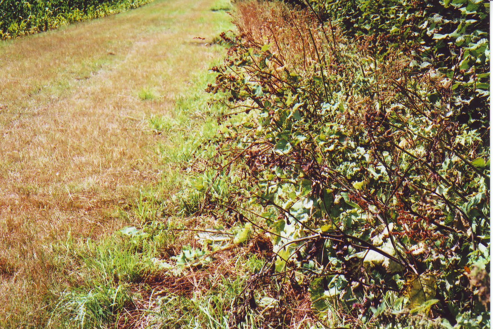
 This is the first section of the stream through the field, taken on the western (Somerset) side, hidden by nettles and other low foliage.
The stream next becomes open, and trampled by cows.

The stream here turns eastwards.

The stream now becomes somewhat overshadowed by foliage.
 Whilst still somewhat overgrown, the stream is now to do a right-hand turn.
The stream here has another stream joining it which comes from Purse Caundle village centre.
The county boundary now leaves the stream which continues along the western edge of Hanover Wood. The boundary meanders for a short distance through a field to the base of Hanover Wood, being O.S. recorded as '6 ft Root of Hedge' on the Somerset side.

The boundary leaves the stream and then skirts around the northern edge of Hanover Wood, up to ST 690 180, contour height 100 metres.
 This is the start of the boundary's run south-westerly along Hanover Wood's eastern edge. It now becomes '15 ft Root of Hedge' on the Purse Caundle (eastern) side.
 This next photo is taken at the gap in the cross hedge (ST 689 178) just seen in the far left-hand distance on the previous one.

This is some 100 yards further along at the point where the woodland boundary takes something of a right turn.

At this point the boundary straightens out again, with a second cross hedge in the distance.

This photograph was taken at the gateway through the cross hedge seen in the previous one at ST 687 176, at Bench Mark 348.7 feet.

Here one has to make a slight detour from the boundary around a patch of waste weeded ground, with the following photograph showing a later backwards view.

This is the view back northwards from the southern end of the waste weeded patch in the previous photograph.


It will be noted that the photograph below was taken just before the bend to the left in the previous one.

It is noted that this eastern edge of Hanover Wood runs roughly parallel to the 300 ft contour which is just inside the woodland.
Along the stretch of boundary in the previous photograph is this signpost

Along the stretch of boundary in the previous photograph is this signpost.

For a short stretch, about halfway along the edge of the Wood, the O.S. recorded 'Free Border'. Perhaps this was the reason for there being at ST 686 173, where a footpath up from Purse Caundle's Manor Farm continues down into the woodland, there being just inside the woodland a large upright thin roughly rectangular stone which could well have been a boundary stone (seen in the centre of photograph).

This is another view of the stone, looking out from the wood into the adjoining field.


 Further along, the shared Shire boundary with Milborne Port parish finishes, and commences with that of Goathill parish (ST 681 167, Bench Mark 380.0 feet). Thus though not strictly part of the Purse Caundle Shire Boundary, shown here is a boundary stone between the parishes of Milborne Port and Goathill, situated just inside a field on the south-western edge of Hanover Wood, at ST 678 168.


The woodland (and boundary) at this hedgeline projects slightly out into the field, which accounts for the curvature in this photograph.


This photograph is looking southwards from an opening in a cross hedge towards Muse Hill woodland, through which the boundary progresses. Note the observation platform on the right, this being hunting country.

The above photograph is the view from the entrance to Muse Hill woodland, back to the point from which the previous photograph had been taken.

This O.S. map section follows the final part of the county boundary through Muse Hill woodland and down to a boundary stream.
This following section of the old Shire Boundary is shared between Purse Caundle and Goathill, for until 1880 the latter was part of Somerset, at which date it was transferred to Dorset. This section was covered by O.S. 26/9430 (Somerset No. 11093). The respective meresmen being Henry Harris overseer for Purse Caundle and Elias Lawrence for Goathill. This view is looking backwards (north) along the eastern edge of Hanover Wood, taken from where the boundary meets another piece of woodland - Muse Hill (ST 678 166). Elias Lawrence was to make the usual statement: 'Property Right. The Owners of Hedges, Banks, and claim six feet space into thr adjoining lands and they - the Owners - can appropriate this space to any purpose they choose; walls are however as a rule built to the extent of property.

This the entrance to Muse Hill woodland. 'Muse' could well be a corrupted spelling of 'Mews', the name of early occupiers of Purse Caundle manor house.


The boundary descent continues until it reaches the point in the next photograph.


A short distance down is a gap in the hedge. The hedge then continues with a ditch running along its middle, which could have been the original boundary. This ditch can just be discernible in this photograph.


The old Purse Caundle-Somerset boundary ends at this stream, which now on its western length forms a boundary between Goathill and Haydon; whilst to the east it forms for a few yards the boundary between Purse Caundle and Haydon before running as a boundary between two Purse Caundle fields.


As already noted, in the Goathill side of the hedge is something of a ditch. This photograph was taken from the Purse Caundle side of the hedge, showing the ditch through the hedge.
Having reached the end of what was the joint county boundary between Dorset and Somerset, we now start a purely inter-parish one - see 1B below.
It will have been noticed that the bulk of the eastern and northern county boundary follows more or less maximum high contour lines, giving Somerset fine views overlooking open Dorset landscape. However, the majority of the western north-south section gives Dorset the high ground overlooking wooded Somerset.
Whilst probable Shire boundary markings such as standing stones and walls have been noted, the dates of their placement are not known.
Since the date of formation of the parish of Purse Caundle is unknown, the reasons for the particular line of its boundary will probably never be known, though as with that of the county boundary, following the line of one or more contours cannot be ruled out. It must be remembered that although county boundaries were defined in Anglo-Saxon times, Purse Caundle as a separate parish was seemingly only first recorded in the 12th century. Before that time - certainly at the time of Domesday - it was part of a larger undefined area known as CANDEL. The parish as such could well have been formed to cover the area(s) of its monastic Manor(s).
 The purely Parish Boundary between Purse Caundle and Haydon was dealt with in O.S. 26/2932 (County of Dorset No. 12564), with the respective meresmen being Henry Harris for Purse Caundle, and George Gosney for Haydon (who had to make his 'X' mark). Henry Harris made the usual declaration of: 'Property Right. The Owners of Hedges Banks &c. claim 4 feet space into the adjoining lands as their property. And they (the owners) can appropriate this space for any purpose they choose. Walls are however as a rule built up to the extent of property.' This four feet claim is at variance with the six feet claimed by adjoining parishes.
Having reached the end of what was the joint county boundary between Dorset and Somerset, we now start a purely inter-parish one - see 1B below.
It will have been noticed that the bulk of the eastern and northern county boundary follows more or less maximum high contour lines, giving Somerset fine views overlooking open Dorset landscape. However, the majority of the western north-south section gives Dorset the high ground overlooking wooded Somerset.
Whilst probable Shire boundary markings such as standing stones and walls have been noted, the dates of their placement are not known.
1B - PURSE CAUNDLE INTER-PARISH BOUNDARY

Since the date of formation of the parish of Purse Caundle is unknown, the reasons for the particular line of its boundary will probably never be known, though as with that of the county boundary, following the line of one or more contours cannot be ruled out. It must be remembered that although county boundaries were defined in Anglo-Saxon times, Purse Caundle as a separate parish was seemingly only first recorded in the 12th century. Before that time - certainly at the time of Domesday - it was part of a larger undefined area known as CANDEL. The parish as such could well have been formed to cover the area(s) of its monastic Manor(s).


Where once maps showed a footbridge across the stream, there is now this form of stepping stones, though on both banks barbed wire blocks access. This photograph was taken from the Purse Caundle bank.

After leaving the stream's foot-crossing from the southern bank, the parish boundary progresses in a right-hand curve across a field (still acting as a boundary between two fields in 1903) to the northern-most corner of Coach Hill Wood. In the 1880s there was apparently a hedge between these two points, but since grubbed up with the route now what would be termed 'Defaced'. The O.S. recorded '4 ft Root of Hedge' on the Haydon side.
The boundary then proceeded up an incline, first along the north-east facing edge of woodland, then along south-west facing edge of other woodland, with O.S. recording '4 ft Root of Hedge' on the Purse Caundle side.

The boundary then goes away to the left (south-eastwards) of the above photograph, along the north-east facing edge of Coach Hill Wood, to a hedge at the far end of the field. O.S. now recorded '4 ft Root of Hedge' on the Haydon (woodland) side.
The boundary goes through the hedge and along another hedgeline until at ST 683 158 it meets with the road going down to Allweston, with O.S. recording '4 ft Root of Hedge' along the Purse Caundle side.
It crosses the road, then for a short distance across the northern tip of a field and meeting at ST 684 157 (approx. Bench Mark 290 feet) the road down to Bishops Caundle.
For a few metres the boundary runs eastwards along the southerly side of this road, before going through a right-angle turn southwards.
After some distance it does another right-angle turn at ST 683 155, going south-eastwards almost parallel with the Bishops Caundle road (behind Folly Farm which was not on the 1903 map). All the while the O.S. still recorded '4 ft Root of Hedge' on the Purse Caundle side. At the point of this latest turn the Purse Caundle met up with the Caundle Marsh parish boundary whose meresman was James Parsons. This zig-zagging may well follow the same pattern as earlier seen in the vicinity of Gospel Ash farm.
The boundary then again meets the Bishops Caundle road at a southerly bend in the latter, ST 686 153, Bench Mark 391 feet, and runs along the road's southerly side, again '4ft Root of Hedge' on the Purse Caundle side.

At ST 692 155 the boundary reaches Rue Lane.
The boundary then proceeds eastwards along the 'Centre of Road', with after a while having Plumley Wood on the north Purse Caundle side.

At the south-east corner of Plumley Wood, the boundary turns north along the Wood's eastern edge, reverting to '4 ft 6 ins Root of Hedge' on the eastern Stourton Caundle side.
Beginning at ST 698 158 there begins an anomaly in that there is at first thought an unexplained curved indentation into the Wood which the boundary follows, and ends at ST 699 161. But study of an old O.S. map shows that this eastern edge of woodland - including the indentation - is parallel to the 400 ft contour which runs just inside the woodland itself.


The boundary turns sharp east at ST 702 166, going up a roadside embankment and eastwards along a field hedge, with '4 ft Root of Hedge' on the south Stourton Caundle side. The hedge is on a low ridge.


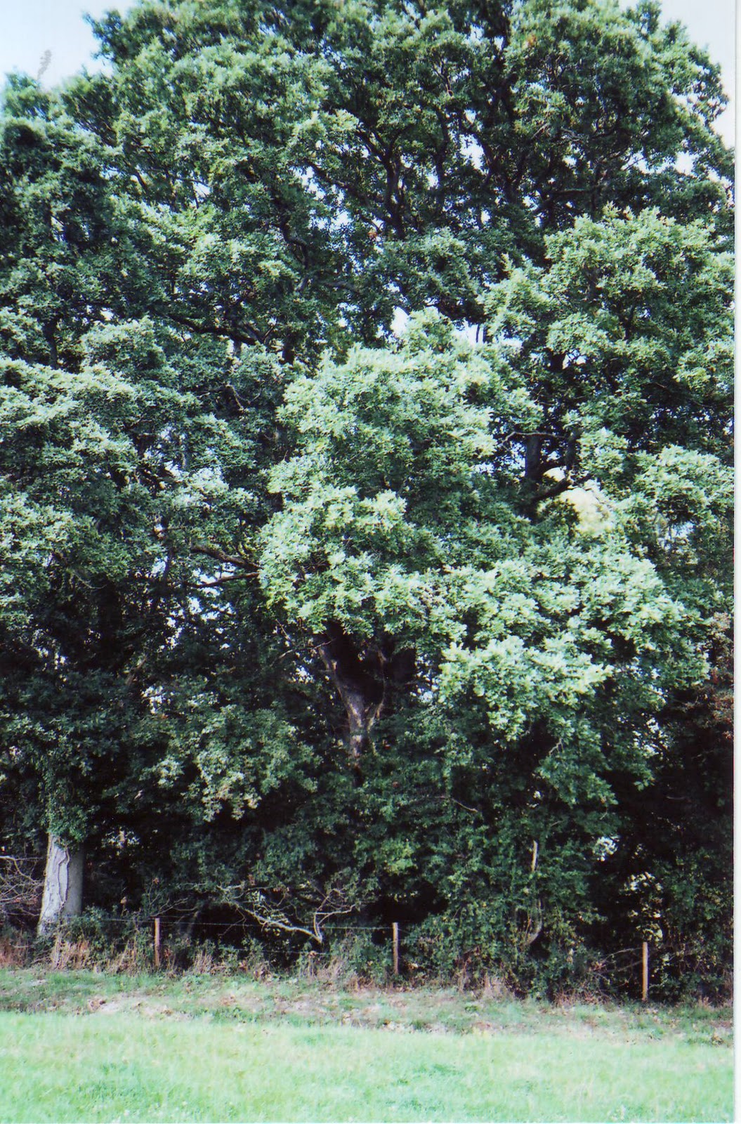
At the junction between these two parishes is this ash tree.


The only known surviving Anglo-Saxon land charter having any connection with Purse Caundle is that granted by King Athelstan to Sherborne Monastery on 26 January 933. This land was in what is now Stalbridge Weston and Stalbridge. Cyril Hart in DNHAS, Volume 86, 1964, was able to follow the probable bounds. The first relevant charter point was "north along the enclosure to Beornred's pasture" which Hart considered to be on the banks of the stream at about ST 701 170, i.e. in this area, but which was not seen during this perambulation.


The edge of the remaining woodland then bears a little leftwards at a field hedgeline on the east/right-hand side, the '4 ft 6 in Root of Hedge' now being outside the woodland on the Stalbridge side. There was only one further relevant charter bound record "on to the high Wifel's Hill", which Hart considered to be Copse House Farm at ST 710 180 - see below.
At the end of the woodland a joint field hedge runs northwards until it meets up at a T-junction (ST 703 177, height 105 metres) with a footpath from Manor Farm running SW-NE. The '4 ft 6 in Root of Hedge' for this short stretch of hedge is on the Purse Caundle side.
The boundary then follows the footpath north-eastwards until it meets the northern edge of Frith Wood (at the point where the 400 foot contour line crosses). The '4 ft 6 in Root of Hedge' for this short section is on the Stalbridge side.


The footpath (but not the boundary) then currently makes a southwards detour around Frith Cottages which have been confirmed as being in Stalbridge parish. This is a photograph taken at the point of detour, showing the steps and gateway of the continuing footpath.


A few yards short of the road hedgeline the defaced boundary turns southwards across to the other side of the entrance driveway to Frith Cottages which are in Stalbridge parish.

The boundary then crosses the Stalbridge Weston Road, to the southern corner of its junction with the road down to Copse House and Stalbridge, at ST 709 180. It was at this corner that the inter-county boundary perambulation began - as at the beginning of this Chapter.
1C - PURSE CAUNDLE MANOR BOUNDARY/(IES)
The Manor boundary is more uncertain to determine, but to all intents and purposes coincided with that of the Parish. It was suggested earlier that the converse may have been the case, with the Parish following the boundary of the Manor(s). The difficulty arises with there being the two original Manors of Athelney and Shaftesbury, which were joined together after the Dissolution, but were apparently considered separated at a later undetermined date.
The earliest known manorial estate map is from about 1780, being possibly compiled at the time Francis Earl Brooke and Earl of Warwick sold the Lordship and manor estate to Sir Richard Hoare. The estate as such seemingly did not by then contain the manor house or adjoining Purse Caundle Farm (Home Farm) and its land. A subsequent map of 1785 for Richard Colt Hoare equally showed the same lack. But what Lordship jurisdiction there still was over these two properties is again not certain. See APPENDIX A1 for fuller discussion on this whole latter aspect.
A 'Map of the Manor of Purse Caundle' (WSRO ref: 3117/4), said to be dated c.1810, contains the whole parish/village. which appears at first glance to substantiate that all three units were totally coincident. But the 1838 Tithe Map again shows a separation between the Manlor Lordship and the manor house with its Home Farm. So between the Tudor grant of the two abbeys' Lordship Manors to the Stourtons and the 1780 estate map, there appears to have been a selling-off of what had been originally the Shaftesbury abbey Manor.
From 1559 any perambulation or 'beating' of the bounds of parishes, etc., apparently became obligatory. At Purse Caundle Manor it was certainly carried out prior to 1590, as witness the Steward's instruction to the Manor Court on 18th September 1590 (see CHAPTER 5). But unfortunately no record of any such "view of the bounds" appears to have survived; and that particular Court instruction is the only reference to a perambulation in known surviving Purse Caundle Manor Court records. With the general introduction of estate maps from the mid-eighteenth century, due to improvement in surveying techniques, such perambulations were to a certain extent to become unnecessary.
- - - - - - - - - - - -
This whole topic of Boundaries is so complex, and research still ongoing, that its complete writing-up is being prolonged for a while.
For those able to attend at the Dorset County Museum this coming Saturday, 23rd October, at 9.30 a.m., there is a Symposium organised by the Dorset Boundary Survey Group, when there will be throughout the day a series of presentations by members of the Group (but not including this author, who hopes in any case to bring along a ring-binder of this total up-dated Post). The cost for the day - including refreshments and lunch - is £
For those able to attend at the Dorset County Museum this coming Saturday, 23rd October, at 9.30 a.m., there is a Symposium organised by the Dorset Boundary Survey Group, when there will be throughout the day a series of presentations by members of the Group (but not including this author, who hopes in any case to bring along a ring-binder of this total up-dated Post). The cost for the day - including refreshments and lunch - is £
To be continued ....................

No comments:
Post a Comment