Sunday, November 29, 2009
PURSE CAUNDLE HISTORY - CHAPTER 1: TOPOGRAPHY - 4. WOODLAND AND ORCHARDS
WOODLAND
A great deal of the area was at one time wooded forest. A conjectural map of Anglo-Saxon England shows a swathe of woodland called Sealwuda, about 10 miles wide and 45 miles long, running slightly north-eastwards between Sherborne and Shaftesbury, starting about ten miles south of Sherborne and ending south of Caln. With the coming of man, wood was needed for house building and fuel; and then agriculture and keeping of animals for food meant further diminution of woodland. But the love of hunting, especially following the norman Conquest, resulted in widespread deafforestation, including this part of Dorset's Blackmore Vale and Forest.At the time of Domesday there was apparently only 15% of the nation's land covered in woodland. Domesday said there was held by Athelney Abbey in 'Candele' an area of 'woodland 3 furlongs long and 2 furlongs wide' - presumably 60 acres (or 24.281 hectares in modern parlance). As the precise boundary area of that time of what would become Purse Caundle is not certain, so is that of the woodland described - though it could well have been a larger Plumley Wood.
It has been recorded that King John (1199-1216) hunted many times in and around the Blackmore Forest. He was also responsible for some disafforesting in the country, e.g. Staffordshire in 1204, so could also have carried out some in Dorset. King Henry III (1216-1272) also hunted in Blackmore, when and where the incident occurrded which supposedly gave rise to the place-name of King's Stag. See CHAPTER 4 for fuller details of this hunting and its consequences.
In 1317, when repairs were to be carried out at Sherborne castle, wood was to be used 'from Gillingham Forest and from Caundel Park.' It is not yet known where this latter location was, though there are several fields called 'Park Hill' situated together between the A30 road and the road leading to Stalbridge Weston. In 1545 there was mention of "Abbottes Wood and Roughcrofte Coppes (6 ac[res].)" - the latter now being the northern part of Plumley Wood (O.S. 52) - see CHAPTER 4 and APPENDIX D.
Coker's Survey of 1623/4 said that long since had the Forest of Blackmore (or Vale of Whitehart) had been disafforested, though not yet Gillingham Forest and Cranborne Chase.
Lewis's Topography of 1844 gives Purse Caundle 'about 100 acres of woodland and copse' out of a total parish area of some 1558 acres. Some 19th century censuses show that a few inhabitants were engaged at times in woodland trades.
There is still the same amount of woodland, with Plumley Wood being by far the largest area, suggested as representing a fragment of the original forested are of Blackmore Vale. The ancient Hanover Wood on the western parish boundary is actually in Milborne Port, whilst Frith Wood to the east is also just outside the parish boundary. Other pockets of woodland and coppice are scattered around the parish, including strips along the inner verges of the main A30 road. Some of this woodland contained fox earths, as are noted in CHAPTER 8.
A small area of tree saplings was planted at Church Farm by the landowner early in 2008.
PURSE CAUNDLE WOODLAND c.1903
O.S. 18: Deadman's Covert 2.492 acres
O.S. 22: Muse Hill 4.132 acres
O.S. 23: Hussen Hanging 6.527 acres
O.S. 48: Stock Wood 1.257 acres
O.S. 52: Plumley Wood 53.562 acres
O.S. 69: Wood House Covert 4.237 acres
O.S. 94: Dole Covert 6.347 acresO.S. 153: Crendle 2.452 acres
O.S. 160: A30 verge 0.262 acres
O.S. 164: A30 verge 0.479 acres
O.S. 172: Gospel Ash 1.170 acres
O.S. 174: Crendle 0.812 acres
O.S. 175: Crendle 0.326 acres
O.S. 192: Caundle Brake 5.869 acres
O.S. 199: Broadsill Copse 10.000 acres (approx)
Total = 99.924 acres
Total parish area = 1558.282 acres = 6.41% approx. woodland
ORCHARDS
In the eighteenth century the Vale of Blackmore was noted as the pre-eminent cider-producing district of Dorset. Purse Caundle was one of the cider-producing parishes.
On the c.1780 Purse Caundle estate map of the then Lord of the Manor, Francis, Earl Brooke and Earl of Warwick, an orchard is symbolised as such immediately south of Tripps Farm buildings; and others just written-in as such at (1) not unsurprisingly where now stand the two 20th century dwellings Court Orchard and Brook Orchard of about 1 1/2 acres, (2) about half an acre on the west side of Well lane, and (3) the six acres 'Great Orchard' field (O.S. 143) eastwards of Church Farm buildings.
On the 1785 estate map of the new Lord of the Manor, Robert Colt Hoare, the same orchards are repeated, except that at Well Lane.
In 1793, cider was valued in Dorset at £1.1s.0d to £1.10s.0d a hogshead of 63 gallons - not the normal 56 gallons.
On the Purse Caundle Tithe Map of 1838 just two orchards are mentioned: both being at Clayhanger - see 1953 below.
In the two illustrated O.S. maps of 1903 (with acknowledgements to Ordnance Survey), orchards will be seen around the parish: just south of Gospel Ash Farm; a small curving area just north of Church Farm buildings; at Clayhanger behind June Cottage and possibly behind Hillside; where is now Court Orchard and Brook Orchard; behind the Manor House; north-east of Manor Farm buildings; and just south of Trip's Farm buildings.


PURSE CAUNDLE ORCHARDS c.1903
O.S. 42: Trip's Farm 2.040 acres
O.S. 55: Clayhanger 0.122 acres
O.S. 63: Clayhanger 2.333 acres
O.S. 106: Manor Farm 1.408 acres
O.S. 116: Purse Caundle (Home) Farm 1.529 acres
O.S. 118: Manor House 0.759 acres
O.S. 122: Court Farm 0.657 acres
O.S. 123: Court Farm 1.880 acres
O.S. 135: Church Farm 1.765 acres
Total = 12.493 acres
At the 1911 Hoare estate sale, (1) Manor Farm had an orchard of nearly 1 1/2 acres east of the farm buildings; (2) Church Farm had just over 1 3/4 acres in a curved strip north of the farm buildings; (3) Court Farm had two orchards totalling just over 2 1/2 acres (north of the farm buildings, and where is now Court Orchard and Brook Orchard); (4) Trip's Farm is shown as having an orchard just south of the farm buildings.At the 1918 Hoare residual estate sale, what was to be June Cottage was described as having a 'Productive Garden and Orchard' with a total of 25 perches.
When Clayhanger smallholding was sold in 1953, it was advertised as containing a 'useful orchard' of just over two acres, and an orchard house with a cider press.
Cider was to be brewed in the 1990s by John Waltham at Manor Farm from his own orchard - see CHAPTER 9.
Vestiges of these orchards still remain around the parish.
Websites of interest:
Dorset Woodlink: Making the most of Dorset's woodlands. www.dorsetaonb.org.uk
www.forestry.gov.uk/ewgs www.dorsetcoppicegroup.org.uk www.dorsetwildlife.co.uk
The Woodland Trust: www.woodlandtrust.org.uk
Symondsbury Apple Project: www.appleproject.org.uk
Thursday, November 19, 2009
PURSE CAUNDLE HISTORY - CHAPTER 2: PRE-CONQUEST PURSE CAUNDLE
Like much of Dorset - as witness for example the extensive chalk deposits - Purse Caundle in pre-historic times seems to to have been under water, but with different younger strata deposits being laid down - see CHAPTER 1 (2: Geology).
According to DNHAS Volume 92, 1970, during September 1970, gas-pipe trench excavations were carried out in a field (Grid ref: ST 687 165) west of the lane running south from Purse Caundle village down to Tripps Farm. In the Fuller's Earth Rock several pieces of a crocodile's


snout were found in the topmost part of the Middle Bathonian Subcontractus Zone, of about 130-140 million years ago, associated with the characterisitic ammonites of this zone apparently found in local gardens, including Tulites modiolaris. The snout was subsequently identified at the British Museum as belonging to Steneosaurus brevidens, originally described from the Oxfordshire Great Oolite where it is common in the Stonesfield Slate (Progracilis Zone), a little earlier than the Purse Caundle specimen. These four specimen pieces are now in the Palaeontology reptile collection of the Natural History Museum in London (Catalogue No. BMNH R 8576) - see illustrations. This apparently the earliest record of a crocodile in Dorset, having been presented to the NHM by Hugh Torrens in 1971, though mistakenly said at that time as having come from nearby Haydon.
The crocodilians, unlike the dinosaurs, persisted through the time of the Cretaceous-tertiary extinctions' event. Steneosaurus was a crocodilian that had become well adapted to a marine way of life. It had a long body and small forelimbs to aid swimming, and a long snout with thin sharp teeth for eating fish. Steneosaurus maintained a heavily armoured body. The rings along the neck acted as protection for the gullet, which was the only unprotected area of its otherwise heavily-armoured body. Its feet had not become modified into flippers. It probably inhabited estuaries rather than the open ocean. A complete specimen has been found elsewhere measuring an impressive 7 1/4 feet in length.
Whether there was any, or how much, Early-Man, Iron Age, Bronze Age, or a later Roman settlement within what would become the immediate village area is not known, as apparently no archaeological research has been undertaken. The heavy clays of the Blackmore Vale inhibited much prehistoric and Roman-British settlement there. However, Neolithic arrowheads are said to have been found in woodland area west of Henstridge village; and probable Iron-Age burials and artifacts on the high ground near Toomer. Pre-Roman Iron Age pottery suggesting occupation has been found as close as adjacent Goathill, as had some Roman artifacts (DNHAS Vol. 80, 1958), and definitely at Marnhull further out into Blackmore Vale.
On the 2001 Ordnance Survey Roman Map, however, it can be seen there was a Roman villa at Sherborne five miles to the West; a closer substantial building just west of Milborne Port; and other finds in the vicinity of Goathill, Henstridge and Stalbridge.
It is thought that with a stream or two, plus springs, within the area of the parish it was possible there would be some later form of early pre-Saxon settlement alongside. With the local water-table being quite close to the surface (in modern times at any rate) wells are not difficult to dig.
Roman and Romano-British items of pottery, etc., and Roman coins have been found - generally by chance - in the area all around Sherborne, including to the East at Henstridge Bowden and Toomer, and south at Bishops Caundle - see C. E. Bean in DNHAS Vol. 72, 1950. A Romano-British cemetery was found by chance at Milborne Port in the 18th century, containing nearly 60 burials, with heads pointing North. No associated settlement has yet been discovered nearby. A same period skeleton was discovered also close to Purse Caundle at neighbouring Stalbridge in 1918. The Romans built the first roads as such, in some instances following already established prehistoric trackways. A Roman road from what is now Weymouth passed through Dorchester (Durnovaria), and onwards just to the west of Yeovil to Ilchester (Lindinis), where there was a large fort. In the Yeovil and Sherborne area it is noted that villas are situated along the line of the River Yeo. (See also CHAPTER 5)
Following the departure of Roman garrisons from Britain c.410, on the severance of Britain from Rome, but not necessarily of the civilian villa occupiers, the Saxons apparently came late to Dorset from the east. They finally overcame the British in the mid-seventh century, in what was later to be called Dorset, to become part of Wessex. The history of Britain in the 5th and 6th centuries has been provided by the British cleric Gildas in his The Ruin of Britain. This has been said to have possibly been written c.550, perhaps in Dorset or Somerset. There was also Bede's Ecclesiastical History of the English People, c.731.
Settlers started to come from northern Germany (Angles and Saxons) and Denmark (Jutes), plus other Germanic groups, and Scandinavians. It was not long (7th century) before Kings demanded protection tribute from the population they governed. The ordinary subsistence farming inhabitants had to render regular payments of agricultural produce (feorm) to their local royal centres. For this purpose the countryside was divided into taxable units called hides - a hide being the amount deemed necessary to support one household.
The year 845 saw the first known mention of the name Dorset: 'Dux Eanwulf with the Somerset men, and Bishop Ealhstan and Ealdorman Osric with the Dorset [Dornsaetum] men, fought against a Danish raiding-army at the mouth of the [River] Parrett [in Bridgwater Bay south of Weston-super-Mare] and made great slaughter there and took the victory.'
Less than a handful of miles eastwards of Purse Caundle is Stalbridge, which is Saxon for 'bridge on piles'.
There is evidence of a West Saxon settlement at Sherborne. But even more exciting has been the information passed to this author that what was considered (by a local doctor) to be a Saxon female skeleton was discovered by chance in the 1980's at Home Farm in Purse Caundle. But unfortunately it was apparent not much cognicance was taken of it by the archaeological fraternity, and in accordance with usual practice it was re-buried.
At Hinton St. Mary (five miles east of Purse Caundle) there is a Roman villa with a 4th century mosaic having a Christian content - XP - the symbol for Christ. There is plenty of evidence of there being Christianity in north Dorset in Saxon times by at least the mid-7th century, at such places as Fontmell Magna and Iwerne Minster. Purse Caundle church apparently has a few Saxon foundation remains of an unknown date, which presumably means there was either some form of adjacent settlement by then, or it was to cater for a collection of scattered surrounding ones. Close to Purse Caundle there were to be abbeys at Shaftesbury (Sceaftsbyri) in 888, and Sherborne (Sciraburn) in 998.
The Diocese of Sherborne was created by King Ine in 705, with his brother Aldhelm (later Saint) being consecrated its first Bishop. Some 350 years later, c.1060, the bishopric was transferred to Sarum.
In 787 there was an early pagan Viking raid on the kingdom from Scandinavia through Portland. Kings AEthelbald in 860, and AEthelbert in 866, the elder brothers of King Alfred (the Great, 871-899), were buried at Sherborne which seems to have become the war-time capital of Wessex during the fight against the Vikings' 'Great Army'. The latter were to be converted to Christianity, and trade with them began. But in early 878 the Danes eventually succeeded in over-running the greater part of Wessex, including Dorset. Alfred retreated to the swampland of Athelney in Somerset, where the legendary incident of his burning of cakes supposedly took place. But in the same summer Alfred defeated the Vikings at Edington, Wiltshire, just north-east of Westbury. He was to eventually push the Vikings back out of Wessex in 880. In gratitude for which he founded Athelney abbey, and apparently endowed it with (Purse) Candel. Before his death in 899 he also reorganised the rota of military service, to forestall any further attacks, and introduced a 'Burghal Hidage' levy.
This military service (or fyrd) was a levy of freemen raised from each hundred, liable to serve in the English Army for a period of two months annually. During that time they were paid and provisioned by the shires. However, if their period of service was extended, then they were charged to the State.
Although it may have already been in existence, it is more likely to have been King Alfred who originated payment of Peter's Pence in the 880s. However, some authorities consider it to have been later by King Cnut (1016-1035), though this opinion was to be based on his letter of 1031 which seems to infer that it was an ancient practice by this time. This was an annual tax payment to the Papal See at Rome of one penny (which were at that time made of silver) by every household in England occupying land worth thirty pence rent a year. Payment of this Rome scot was to be made on Lammas Day (the Saint's Day of St. Peter ad Vincula - 1st August). There was apparently a substantial fine for neglect to pay.

Illustrated on the left is a fragment of a real Anglo-Saxon hammered silver penny coin.
Below are reproductions of King Alfred silver penny coins of the period 871-891.
 In 973 King Eadgar (959-975) carried out a major reform of the silver coinage, which was now to be uniform throughout the whole country. It was to be renewed every six to seven years, when people had to travel to their nearest mint centre (which could be at quite some distance) and exchange their old penny and halfpenny coins for new. Fortunately for the inhabitants of Candel there was a mint at Milborne Port at some time during the Anglo-Saxon period.
It is difficult to equate monetary values of this period with that of the 21st century. According to the website that discusses this problem <www.regia.org/costs.htm> a value of one Saxon silver penny (1d) is considered to be £20. This is a somewhat over simplification, but accurate enough for this website article, and thus this History. The values of various commodities of that period have been considered to be: Ewe and lamb @ 12 pence = £240; Fleece @ 2d = £40; Fox skin @ 8d = £160; Wolf skin @ 8d = £160; Hive of bees @ 24d = £480; and further pro rata a Sword @ 240d, and a Fyrdman's pay per month @ 120d.
In 978 King Edward (the Martyr - 975-978), murdered at Corfe Castle in Dorset, and being finally buried at Shaftesbury the following year. Some time after 980 King AEthelred II (978-1016) brought into use a hill fort at South Cadbury, just over the border in Somerset and only some seven miles from what is now Purse Caundle, to counter further Viking raids and/or invasion. In 982-998 there were further attacks and incursions by the Danes into Dorset, such that by 1001 even Shaftesbury (12 miles distant) was being considered as unsafe for the nunnery there. In 1003, King Swein of Denmark landed at Exeter, and marched to, and destroyed, Sherborne and Shaftesbury. As well as irregular tributes to the Vikings by King AEthelred to buy peace, in 1012 he instituted a Danegeld tax payable by everyone, collectable from every hide of land, to pay for his Scandinavian mercenaries. Some hardship apparently resulted. Archbishop Wulfstan in his 'Sermon of the Wolf to the English', written at the time, describes the sad lot of many poor people, when the heavy demands for tributes were added to years of poor harvests and cattle disease.
King Cnut came to plunder Wessex in 1015/1016. There was a battle between the Saxons and Vikings in 1016, thought to have been at Penselwood, which is three miles north-east of Wincanton, Somerset, and just north of the present A303 trunk road. (There is believed to have been an earlier West Saxon battle here in 658.) Cnut died in 1035 at Shaftesbury, with his heart possibly being buried at Shaftesbury Abbey, and his body buried at Winchester.
England was originally much covered in dense woodland. But generations of Celts, Romans, and then Saxons gradually cleared the trees, starting with the thinly wooded upland areas such as Salisbury Plain. Then moving into the lowlands, making space to grow cereals, and pasture to rear cattle and sheep. Apparently what was to become Purse Caundle was still covered by woodland in Anglo-Saxon times. As forests were cleared, flowers spread, and marsh and river-bank varieties colonised the meadows. There were blue cornflowers and red poppies in the fields, originally introduced by Neolithic settlers from the Mediterranean. The woodlands were carpeted with bluebells growing among the brambles and ferns. On the downlands wild thyme, rock roses, and harebells flourished. There were cowslips, primroses, honeysuckle, wild daffodils, foxgloves and forget-me nots.
Long before William the Conqueror invaded England in 1066 a well-ordered pattern of life had been established, not only nationally, but seemingly in Candel - then an overall name for what would have been a collection of scattered homesteads and/or farms. When the Saxons had arrived on our shores some five centuries earlier, they gradually reshaped the land the Romans had left. They parcelled out the land into small divisions, generally conforming to two different patterns, i.e. its configuration, and type of soil. In the instance of (Purse) Caundle, on the edge of the Blackmoor Vale, this was to establish a central farm, and then to clear outlying patches and make smaller farms there, joined to the parent farm by paths through woodland or uncleared common. It was King Alfred who divided Saxon lands into Shires (from the Saxon word Scyre - to cut or divide), and sub-divided into smaller Hundreds and Tythings.

Illustrated left is a reproduction of a silver penny of King Harold II, 1066.
Illustrated below is a fly-leaf of an old Anglo-Saxon Gospel book, said to have been in use in Widcombe, Devon, in the time of the Conqueror.
 On the matter of the language of that time, the 19th century Dorset dialect poet, the Rev. William Barnes, maintained "That there was a 'pure' form of English which all native speakers understood. That 'pure' English was derived from Anglo-Saxon and Teutonic origins. If King Alfred's capital of England had not been moved to London from Winchester then the Dorset dialect would still be Standard English. That the Dorset dialect was the closest form of modern English to the Anglo-Saxon language from which it was derived." Barnes published his opinions in the Gentleman's Magazine in 1840. Doctor Alan Chedzoy discussed this in his article 'Those Terrible Marks Of The Beast: Barnes, Hardy And The Dorset Dialect' in The Hardy Society Journal, Autumn 2008. R. D. N. Somerset and W. D. Lang also wrote articles about Dorset dialect words in the DNHAS, Volume 85.
The famed monk AElfric (Grammaticus), c.950-c.1025, wrote books in 'Old English', rather than Latin. From about 987 to 1002 he was at Cerne Abbas abbey, and it was then he wrote his Latin Colloquy, probably for the young novices there. It contained descriptions of various contemporary peasants' lives and trades, quite probably relevant to and thus drawn from the local Dorset area:
 'Ploughman "Oh I work very hard. I go out at daybreak driving the oxen to the field, and yoke them to the plough; for fear of my lord, there is no winter so severe that I dare hide at home; but the oxen, having been yoked and the share and coulter [sharp blade] fastened to the plough, I must plough a full acre or more every day . . . I have a lad driving the oxen with a goad, who is now hoarse because of the cold and shouting. . . I do more than that, I have to fill the oxen's bin with hay, and water them and carry their muck outside. . . It's hard work, because I am not free."
 Regarding the local Candel land-holding seven thegns later mentioned in Domesday in 1086, these and others were persons holding land from the King by special grant. Formerly 'thegn' was a name used of the King's ministers and military companions, and being awarded land by the king or another superior as a reward for military service. Thegns ranked between freemen and hereditary nobles. They were free to choose any lord as their patron and protector of their lands, (as were certain other outright freeholders of land around the country which was not subject to ownership by the king). Otherwise other lands could be 'tied to a particular manor or lord.
 Five hides of approximately 120 acres each (a hide valued at 240 pence = £4,800) was considered by custom as the tenement necessary for the proper outfit of a knight or thegn, i.e. a tenement which made him independent of township arrangement and personal work, which raised and contrasted him with the peasant virgaters around him. It implied to begin with, that the thegn was to find means of sustenance not merely for himself, but for his retinue - the heavily armed warrior being as a rule surrounded by a few lightly armed henchmen. Having a holding of 5 hides placed him in the position of a military follower connected to the king by the ties of direct or indirect patronage.

On checking with the College of Arms, London, this author was informed that there was no record of it having granted such arms. But it was suggested that the Purse family may have borrowed the heraldry of HETON and changed the colours, i.e. Heaton/Heton of Grovelay Hall, Worcestershire; of Winkell, Lincolnshire, and of London: Argent, six trefoils slipped vert, 2 and 1, 2 and 1. Crest: A pelican or, legged sa, vulning herself ppr.
According to DNHAS Volume 92, 1970, during September 1970, gas-pipe trench excavations were carried out in a field (Grid ref: ST 687 165) west of the lane running south from Purse Caundle village down to Tripps Farm. In the Fuller's Earth Rock several pieces of a crocodile's


snout were found in the topmost part of the Middle Bathonian Subcontractus Zone, of about 130-140 million years ago, associated with the characterisitic ammonites of this zone apparently found in local gardens, including Tulites modiolaris. The snout was subsequently identified at the British Museum as belonging to Steneosaurus brevidens, originally described from the Oxfordshire Great Oolite where it is common in the Stonesfield Slate (Progracilis Zone), a little earlier than the Purse Caundle specimen. These four specimen pieces are now in the Palaeontology reptile collection of the Natural History Museum in London (Catalogue No. BMNH R 8576) - see illustrations. This apparently the earliest record of a crocodile in Dorset, having been presented to the NHM by Hugh Torrens in 1971, though mistakenly said at that time as having come from nearby Haydon.
The crocodilians, unlike the dinosaurs, persisted through the time of the Cretaceous-tertiary extinctions' event. Steneosaurus was a crocodilian that had become well adapted to a marine way of life. It had a long body and small forelimbs to aid swimming, and a long snout with thin sharp teeth for eating fish. Steneosaurus maintained a heavily armoured body. The rings along the neck acted as protection for the gullet, which was the only unprotected area of its otherwise heavily-armoured body. Its feet had not become modified into flippers. It probably inhabited estuaries rather than the open ocean. A complete specimen has been found elsewhere measuring an impressive 7 1/4 feet in length.
Whether there was any, or how much, Early-Man, Iron Age, Bronze Age, or a later Roman settlement within what would become the immediate village area is not known, as apparently no archaeological research has been undertaken. The heavy clays of the Blackmore Vale inhibited much prehistoric and Roman-British settlement there. However, Neolithic arrowheads are said to have been found in woodland area west of Henstridge village; and probable Iron-Age burials and artifacts on the high ground near Toomer. Pre-Roman Iron Age pottery suggesting occupation has been found as close as adjacent Goathill, as had some Roman artifacts (DNHAS Vol. 80, 1958), and definitely at Marnhull further out into Blackmore Vale.
On the 2001 Ordnance Survey Roman Map, however, it can be seen there was a Roman villa at Sherborne five miles to the West; a closer substantial building just west of Milborne Port; and other finds in the vicinity of Goathill, Henstridge and Stalbridge.
It is thought that with a stream or two, plus springs, within the area of the parish it was possible there would be some later form of early pre-Saxon settlement alongside. With the local water-table being quite close to the surface (in modern times at any rate) wells are not difficult to dig.
Roman and Romano-British items of pottery, etc., and Roman coins have been found - generally by chance - in the area all around Sherborne, including to the East at Henstridge Bowden and Toomer, and south at Bishops Caundle - see C. E. Bean in DNHAS Vol. 72, 1950. A Romano-British cemetery was found by chance at Milborne Port in the 18th century, containing nearly 60 burials, with heads pointing North. No associated settlement has yet been discovered nearby. A same period skeleton was discovered also close to Purse Caundle at neighbouring Stalbridge in 1918. The Romans built the first roads as such, in some instances following already established prehistoric trackways. A Roman road from what is now Weymouth passed through Dorchester (Durnovaria), and onwards just to the west of Yeovil to Ilchester (Lindinis), where there was a large fort. In the Yeovil and Sherborne area it is noted that villas are situated along the line of the River Yeo. (See also CHAPTER 5)
Following the departure of Roman garrisons from Britain c.410, on the severance of Britain from Rome, but not necessarily of the civilian villa occupiers, the Saxons apparently came late to Dorset from the east. They finally overcame the British in the mid-seventh century, in what was later to be called Dorset, to become part of Wessex. The history of Britain in the 5th and 6th centuries has been provided by the British cleric Gildas in his The Ruin of Britain. This has been said to have possibly been written c.550, perhaps in Dorset or Somerset. There was also Bede's Ecclesiastical History of the English People, c.731.
Settlers started to come from northern Germany (Angles and Saxons) and Denmark (Jutes), plus other Germanic groups, and Scandinavians. It was not long (7th century) before Kings demanded protection tribute from the population they governed. The ordinary subsistence farming inhabitants had to render regular payments of agricultural produce (feorm) to their local royal centres. For this purpose the countryside was divided into taxable units called hides - a hide being the amount deemed necessary to support one household.
The year 845 saw the first known mention of the name Dorset: 'Dux Eanwulf with the Somerset men, and Bishop Ealhstan and Ealdorman Osric with the Dorset [Dornsaetum] men, fought against a Danish raiding-army at the mouth of the [River] Parrett [in Bridgwater Bay south of Weston-super-Mare] and made great slaughter there and took the victory.'
Less than a handful of miles eastwards of Purse Caundle is Stalbridge, which is Saxon for 'bridge on piles'.
There is evidence of a West Saxon settlement at Sherborne. But even more exciting has been the information passed to this author that what was considered (by a local doctor) to be a Saxon female skeleton was discovered by chance in the 1980's at Home Farm in Purse Caundle. But unfortunately it was apparent not much cognicance was taken of it by the archaeological fraternity, and in accordance with usual practice it was re-buried.
At Hinton St. Mary (five miles east of Purse Caundle) there is a Roman villa with a 4th century mosaic having a Christian content - XP - the symbol for Christ. There is plenty of evidence of there being Christianity in north Dorset in Saxon times by at least the mid-7th century, at such places as Fontmell Magna and Iwerne Minster. Purse Caundle church apparently has a few Saxon foundation remains of an unknown date, which presumably means there was either some form of adjacent settlement by then, or it was to cater for a collection of scattered surrounding ones. Close to Purse Caundle there were to be abbeys at Shaftesbury (Sceaftsbyri) in 888, and Sherborne (Sciraburn) in 998.
The Diocese of Sherborne was created by King Ine in 705, with his brother Aldhelm (later Saint) being consecrated its first Bishop. Some 350 years later, c.1060, the bishopric was transferred to Sarum.
In 787 there was an early pagan Viking raid on the kingdom from Scandinavia through Portland. Kings AEthelbald in 860, and AEthelbert in 866, the elder brothers of King Alfred (the Great, 871-899), were buried at Sherborne which seems to have become the war-time capital of Wessex during the fight against the Vikings' 'Great Army'. The latter were to be converted to Christianity, and trade with them began. But in early 878 the Danes eventually succeeded in over-running the greater part of Wessex, including Dorset. Alfred retreated to the swampland of Athelney in Somerset, where the legendary incident of his burning of cakes supposedly took place. But in the same summer Alfred defeated the Vikings at Edington, Wiltshire, just north-east of Westbury. He was to eventually push the Vikings back out of Wessex in 880. In gratitude for which he founded Athelney abbey, and apparently endowed it with (Purse) Candel. Before his death in 899 he also reorganised the rota of military service, to forestall any further attacks, and introduced a 'Burghal Hidage' levy.
This military service (or fyrd) was a levy of freemen raised from each hundred, liable to serve in the English Army for a period of two months annually. During that time they were paid and provisioned by the shires. However, if their period of service was extended, then they were charged to the State.
Although it may have already been in existence, it is more likely to have been King Alfred who originated payment of Peter's Pence in the 880s. However, some authorities consider it to have been later by King Cnut (1016-1035), though this opinion was to be based on his letter of 1031 which seems to infer that it was an ancient practice by this time. This was an annual tax payment to the Papal See at Rome of one penny (which were at that time made of silver) by every household in England occupying land worth thirty pence rent a year. Payment of this Rome scot was to be made on Lammas Day (the Saint's Day of St. Peter ad Vincula - 1st August). There was apparently a substantial fine for neglect to pay.

Illustrated on the left is a fragment of a real Anglo-Saxon hammered silver penny coin.
Below are reproductions of King Alfred silver penny coins of the period 871-891.
 In 973 King Eadgar (959-975) carried out a major reform of the silver coinage, which was now to be uniform throughout the whole country. It was to be renewed every six to seven years, when people had to travel to their nearest mint centre (which could be at quite some distance) and exchange their old penny and halfpenny coins for new. Fortunately for the inhabitants of Candel there was a mint at Milborne Port at some time during the Anglo-Saxon period.
It is difficult to equate monetary values of this period with that of the 21st century. According to the website that discusses this problem <www.regia.org/costs.htm> a value of one Saxon silver penny (1d) is considered to be £20. This is a somewhat over simplification, but accurate enough for this website article, and thus this History. The values of various commodities of that period have been considered to be: Ewe and lamb @ 12 pence = £240; Fleece @ 2d = £40; Fox skin @ 8d = £160; Wolf skin @ 8d = £160; Hive of bees @ 24d = £480; and further pro rata a Sword @ 240d, and a Fyrdman's pay per month @ 120d.
In 978 King Edward (the Martyr - 975-978), murdered at Corfe Castle in Dorset, and being finally buried at Shaftesbury the following year. Some time after 980 King AEthelred II (978-1016) brought into use a hill fort at South Cadbury, just over the border in Somerset and only some seven miles from what is now Purse Caundle, to counter further Viking raids and/or invasion. In 982-998 there were further attacks and incursions by the Danes into Dorset, such that by 1001 even Shaftesbury (12 miles distant) was being considered as unsafe for the nunnery there. In 1003, King Swein of Denmark landed at Exeter, and marched to, and destroyed, Sherborne and Shaftesbury. As well as irregular tributes to the Vikings by King AEthelred to buy peace, in 1012 he instituted a Danegeld tax payable by everyone, collectable from every hide of land, to pay for his Scandinavian mercenaries. Some hardship apparently resulted. Archbishop Wulfstan in his 'Sermon of the Wolf to the English', written at the time, describes the sad lot of many poor people, when the heavy demands for tributes were added to years of poor harvests and cattle disease.
King Cnut came to plunder Wessex in 1015/1016. There was a battle between the Saxons and Vikings in 1016, thought to have been at Penselwood, which is three miles north-east of Wincanton, Somerset, and just north of the present A303 trunk road. (There is believed to have been an earlier West Saxon battle here in 658.) Cnut died in 1035 at Shaftesbury, with his heart possibly being buried at Shaftesbury Abbey, and his body buried at Winchester.
England was originally much covered in dense woodland. But generations of Celts, Romans, and then Saxons gradually cleared the trees, starting with the thinly wooded upland areas such as Salisbury Plain. Then moving into the lowlands, making space to grow cereals, and pasture to rear cattle and sheep. Apparently what was to become Purse Caundle was still covered by woodland in Anglo-Saxon times. As forests were cleared, flowers spread, and marsh and river-bank varieties colonised the meadows. There were blue cornflowers and red poppies in the fields, originally introduced by Neolithic settlers from the Mediterranean. The woodlands were carpeted with bluebells growing among the brambles and ferns. On the downlands wild thyme, rock roses, and harebells flourished. There were cowslips, primroses, honeysuckle, wild daffodils, foxgloves and forget-me nots.
Long before William the Conqueror invaded England in 1066 a well-ordered pattern of life had been established, not only nationally, but seemingly in Candel - then an overall name for what would have been a collection of scattered homesteads and/or farms. When the Saxons had arrived on our shores some five centuries earlier, they gradually reshaped the land the Romans had left. They parcelled out the land into small divisions, generally conforming to two different patterns, i.e. its configuration, and type of soil. In the instance of (Purse) Caundle, on the edge of the Blackmoor Vale, this was to establish a central farm, and then to clear outlying patches and make smaller farms there, joined to the parent farm by paths through woodland or uncleared common. It was King Alfred who divided Saxon lands into Shires (from the Saxon word Scyre - to cut or divide), and sub-divided into smaller Hundreds and Tythings.

Illustrated left is a reproduction of a silver penny of King Harold II, 1066.
Illustrated below is a fly-leaf of an old Anglo-Saxon Gospel book, said to have been in use in Widcombe, Devon, in the time of the Conqueror.
On the matter of the language of that time, the 19th century Dorset dialect poet, the Rev. William Barnes, maintained "That there was a 'pure' form of English which all native speakers understood. That 'pure' English was derived from Anglo-Saxon and Teutonic origins. If King Alfred's capital of England had not been moved to London from Winchester then the Dorset dialect would still be Standard English. That the Dorset dialect was the closest form of modern English to the Anglo-Saxon language from which it was derived." Barnes published his opinions in the Gentleman's Magazine in 1840. Doctor Alan Chedzoy discussed this in his article 'Those Terrible Marks Of The Beast: Barnes, Hardy And The Dorset Dialect' in The Hardy Society Journal, Autumn 2008. R. D. N. Somerset and W. D. Lang also wrote articles about Dorset dialect words in the DNHAS, Volume 85.The famed monk AElfric (Grammaticus), c.950-c.1025, wrote books in 'Old English', rather than Latin. From about 987 to 1002 he was at Cerne Abbas abbey, and it was then he wrote his Latin Colloquy, probably for the young novices there. It contained descriptions of various contemporary peasants' lives and trades, quite probably relevant to and thus drawn from the local Dorset area:
'Ploughman "Oh I work very hard. I go out at daybreak driving the oxen to the field, and yoke them to the plough; for fear of my lord, there is no winter so severe that I dare hide at home; but the oxen, having been yoked and the share and coulter [sharp blade] fastened to the plough, I must plough a full acre or more every day . . . I have a lad driving the oxen with a goad, who is now hoarse because of the cold and shouting. . . I do more than that, I have to fill the oxen's bin with hay, and water them and carry their muck outside. . . It's hard work, because I am not free."Shepherd "In the early morning I drive my sheep to their pasture, and in the heat and cold, stand over them with dogs, lest wolves devour them; and I lead them back to their folds and milk them twice a day, and move their folds; and in addition I make cheese and butter; and I am loyal to my lord."
Oxherd "I work hard. When the ploughman unyokes the oxen, I lead them to pasture, and I stand over them all night watching for thieves; and then in the early morning I hand them over to the ploughman well fed and watered."
Huntsman " I am a huntsman [of the king]. I weave myself nets and set them in a suitable place, and urge on my dogs so that they chase the wild animals until they come into the nets unawares and are thus ensnared; and I kill them in the nets. I can hunt without nets. I hunt for wild animals with fast dogs. I wasn't hunting today, because its Sunday; but I was out hunting yesterday. [I caught] two stags and a boar. I took the stags in nets, and the boar I killed. The dogs drove it towards me, and I stuck it quickly, standing there in its path. A huntsman mustn't be afraid, because all sorts of wild animals live in the woods. Whatever I take I give to the king, since I am his huntsman. He clothes and feeds me well, and sometimes give me a horse or ring so that I follow my trade more willingly."
Because of the nature of the various possible holding of the Manor and lands, these poor inhabitants could have been subject to the lordship of either king, abbot/abbess, or thegn, with varying degrees of supervision - see above and below, and later CHAPTERS and APPENDICES.
According to the Rectitudines Singularum Personarum ('Rights and Ranks of People'), probably dated during the half century before the Norman Conquest, i.e. at the time of Edward the Confessor, among the many obligations described were:
'Thegn's Law: The law of the thegns is that he be entitled to his book-right [land protected by charter], and that he shall contribute three things in respect of his land: armed service, and the repairing of fortresses and work on bridges. Also in respect of many estates, further service arises on the king's order such as service connected with the deer fence at the king's residence, and equiping a guard ship, and guarding the coast, and guarding the lord, and military watch, almsgiving and church dues and many other various things.
About the Ox-herd. The ox-herd must pasture 2 oxen or more with the lord's herd on the common pasture with the cognizance of the overseer. Let him earn thereby shoes and gloves for himself. And his cow for food must go with the lord's oxen.
About the Shepherd. A shepherd's due is that he should have 12 nights' dung at Christmas, and 1 lamb from the year's young ones, 1 bell-wether's fleece [presumably for making of clothing], and the milk of his flock for a week after the equinox, and a bowl-full of whey or buttermilk all summer [possibly for butter and cheese making].'
Nothing was specifically mentioned for ploughmen, but could well have been included in more general rights and obligations of tenants. But all these could vary from lordship to lordship, and custom of the estate/manor.
Long before William the Conqueror invaded England in 1066, a well-ordered pattern of life had been established, not only nationally but seemingly here in CANDEL - then an overall name for what seemed a collection of scattered homesteads and/or farms. When the Saxons arrived on our shores some five centuries earlier, they gradually reshaped the land the Romans had left. They parcelled out the land into small divisions, generally conforming to two different patterns, i.e. its configuration, and type of soil. In the instance of [Purse] Caundle, on the edge of the Blackmoor Vale, this was to establish a central farm, and then clear outlying patches amd make smaller farms there, joined to the parent farm by paths through woodland or uncleared common. It was King Alfred who divided Saxon lands into Shires (from the Saxon word Scyre - to cut or divide); and sub-divide into smaller Hundreds and Tythings.
The soil of the kingdom was to be pieced out in large patches to provide for (1) Thegns (thanes) - lesser Anglo-Saxon nobles of the military and administrative profession, and (2) people of the ecclesiastical profession.

 Five hides of approximately 120 acres each (a hide valued at 240 pence = £4,800) was considered by custom as the tenement necessary for the proper outfit of a knight or thegn, i.e. a tenement which made him independent of township arrangement and personal work, which raised and contrasted him with the peasant virgaters around him. It implied to begin with, that the thegn was to find means of sustenance not merely for himself, but for his retinue - the heavily armed warrior being as a rule surrounded by a few lightly armed henchmen. Having a holding of 5 hides placed him in the position of a military follower connected to the king by the ties of direct or indirect patronage.
The whole position of thegns is discussed by such as Vinogradoff and Harrison - see the BIBLIOGRAPHY.
It was said in the 1st edition of Hutchins that:
It was said in the 1st edition of Hutchins that:
'The manor [of what was to become Purse Caundle] seems in the Saxon times to have been given by King Aethelstan to the monastery of Athelney, co. Somerset, founded by him A.D. 878. Others say, Robert, Earl of Morton gave the manor of Candel to the Abbot of Athelney [in exchange for another].'
Hutchins was prone to inaccuracies, and this is an instance. It will be noticed immediately the disparity in dates, etc. There had been Athelstan I of East Anglia c.850, and the Viking invader Athelstan II of Anglia 878-890. As was stated above, Athelney abbey had in fact been founded by King Alfred of Wessex, who reigned 871-899. His grandson Athelstan's reign was later in 924-939 (having been born c.895). This error was to be perpetuated by the editors of the subsequent 2nd and 3rd editions of Hutchins, as well as by writers who seemingly accepted what was published there.
Phillimore notes that this land is identified with the early record of the unnamed gift of four hides of land by King Alfred in the Sherborne Hundred Book of Fees (Testa de Nevill), page 90 - see CHAPTER 3.
The Chairman of The Manorial Society, Robert Smith, has aptly written a comprehensive but succinct description of Manors, and Lordships of such. At this point it is worth quoting from this:
'Lordships of the Manor are among the oldest titles in England and pre-date the Norman Conquest [of 1066].
'Historians are not agreed on how the word Manor originated. It has been suggested that it is an import, manoir, or perhaps even older, from the Latin, manerium.. Nor are historians sure whether it was a purely Saxon concept, its origins lying in the need for self-defence down the east coast against succeeding incursions by Germanic tribes and later Vikings.
'They are agreed, however, that the Manor was the pivot of the Feudal System, defined by the 11th century "by certain ecclesiastics who propounded the theory that human society was divided into three orders, the oratores, the bellatores, and the laboratores: those who protected it with their prayers and their swords, and those who tilled the earth to support the other two classes." (Dr. A. P. M. Wright, Senior Assistant Editor, VCH, writing in the Bulletin of the Manorial Society of Great Britain, 1981)
'By the reign of Edward the Confessor (1042-1066), the Lord of the Manor, be he the local leader, or some great suzerain, such as Earl Godwinson of Mercia, was the most important person in village affairs, whether it be collecting taxes for the King or dispensing "high justice", the power to inflict death in his courts.
'In return for his protection and the land in gave them, the people on the Manor, from slaves to freemen, owed their Lord certain services, ranging from money rents to working so many days a week on the Lord's "home farm", or demesne, without pay (week-work). In theory, most men held their land "at pleasure", though in practice the "customary tenants", or villeins, were fairly secure, provided they undertook their services: week-work, the harvest boon (precaria) when they helped the Lord get his corn in, used the Lord's mill to grind their corn and his fold for their animals so that he might benefit from the manure on his land.
'If the tenants of the Manor disagreed, they went before the manorial court, presided over by one of the Lord's officers, usually the Bailiff, who decided and imposed fines often called "arbitary" though, in fact, usually determined by custom. If there were some crime committed, the Lord could arrest, try, and punish up to "pit and gallows", gibbet and mutilation.'
At Gillingham, Dorset, in 1042, Edward the Confessor was proclaimed King by the Witan - the royal council. He was to be crowned at Winchester on Easter Day 1043. He died 5th January 1066, to be succeeded by one of two claimants, Harold II. Then just after Easter, on Monday, 24th April 1066, "Men looked to the sky, and there they saw such a token in the heavens as no man had ever seen before. Not only all over England but, as men deemed, over much of the world, the sky was ablaze with a mighty mass of flame, which no man doubted was sent to kindle a fire upon earth." This omen of misfortune was later to be known as the regularly recurrent Halley's Comet, returning every 75-77 years to our skys. On this occasion it was visible in England from 24th-30th April. It was a prelude of course to the Norman invasion at the end of September the same year, and the subsequent decisive Battle of Hastings on Saturday, 14th October, when the Saxon thegns and fyrdmen were defeated, and King Harold killed.
William the Norman, the other claimant to the English throne, was the illegitimate son of Robert I, Duke of Normandy - his unmarried mother being Herleve. She subsequently married Herluin of Conteville, and they had two sons: Odo who became Bishop of Bayeux, and Robert later Count of Mortain. Both were thus half-brothers of William, who because of his ancestry was to be known as 'the Bastard'.
The whole episode was subsequently recorded on the famous Bayeux Tapestry. One frame shows the three brothers in conference before the Battle. It is accepted by most scholars that the Tapestry was made in the south of England before 1082. In the Tapestry's borders are little vignettes of life of the times, illustrating such occupations as ploughing, harrowing, and slinging at game.
When William ordered in 1086 the survey of England which culminated in the compilation of the Domesday Book, it was to record the situation as at that time as compared with that twenty years earlier in King Edward the Confessor's time pre-1066 - Tempore Regis Edwardi (T.R.E.) - see CHAPTER 3.
The relevant Domesday Book entries which include the pre-Conquest situation are:
(1) 'The abbot [of Athelney abbey in Somerset]has [in Dorset] 1 manor which is called Candel which 7 thegns held T.R.E. and they could go to any lord, which paid geld for 4 hides and 1 1/2 virgates. . .'
(2) 'Lands of the King's Thegns . . . Saeward in [Purse] CANDELE holds 2 1/2 virgates of land. He himself held them T.R.E.' [Saeward seems to have also held lands in Somerset, e.g. not far away at Horsington.]
Two bordars hold the fourth part of 1 virgate of land . . . They themselves held it freely T.R.E.''
How the above situation regarding land ownership by thegns applied to (Purse) Caundle is not absolutely clear. As the seven thegns in 1066 who held the land there 'could go to whichever lord they would' implies that such land was not at that time in ownership of Athelney Abbey, but rather of the King. And who then was the Lord of thegn Saeward and the two bordars?
Nobody is sure how, or exactly when Purse Caundle received its full name, being first recorded as such in the early 13th century; or even when it became a separate entity from being just a part of the much larger area known as Candel (or its variant spellings).
Ekwall and Watts both surmise that 'Purse' could be derived from the Old English 'preosta', meaning 'priest', possibly because it belonged to Athelney Abbey. It was also suggested that 'Caundle' was the name of the nearby chain of hills. It is now generally believed to be Celtic, named afer the stream - Caundle Brook and its own tributaries - that run through it and the other villages with Caundle in their name. But this subject will be further discussed in CHAPTER 4.
But now would seem an opportune place to endeavour to determine the foundation or origins of the place known as Candel/Candle/Caundle. As 'Purse' does not occur until the 13th century this would normally be considered not to be the point at which to discuss this naming. That is until one learns about the following situation.
The owner and occupier of Purse Caundle manor house from 1967 to 1984 was Mr. Ralf Winklemann. During that period the house was open to the public on certain days. Amongst one such group of visitors was Mrs P. M. McCarthy from Liverpool. The following correspondence was the result:
'20 Muirhead Ave East
West Derby
Liverpool L11 1EJ
28.9.79.
Dear Mr Winkleman
I am very sorry I have been so long sending you the copy of the little bit of the 'Purse' family, which I promised you on our visit to Purse Caundle.
I hope it will be of some interest to you.
ours sincerely,
P. M. McCarthy. (Mrs)
(nee Purse)'
'5635 Netherland Ave
Avondale
10071
New York City
USA
Oct 20.70
Dear George
Enclosed is a photograph of the two coats of arms which I made a few years ago. The colours have started to fade, also you will notice I have had a few sheets of notepaper printed from the Die you gave me. I have over the past few year done good a lot of research into the family and have now a few facts. I traced the origins of the family to the year 1055 A.D. 11 years before William of Normandy. In the Dorchester records there is a documented [sic] dated 1055 AD which states that Purse the elder applied for permission to build cottages to house 175 serf families on the land he owned which was situated in the centre of the original White Hart forest along the counties hills. When finished he called the village 'Purse Caundle'. About 220 years later they built a Church and a Manor House. The Church is still standing but in the 14th century the manor house burnt down and another one was built. It is still standing, but is now a museum - over the centuries the families sold or gave as wedding dowries all the land - now there is none left. The only piece of farm land is at Chard nearby, owned by a Purse family. The Coat of Arms on the left is the first one issued in Dorset - on the photograph the notation circa 1050 does not refer to the date it was issued, it only refers to the date the family was recorded.. On the right the first record of the Surrey branch was circa 1265 A.D.
I had an expert in New York explain the symbols of the Coat of Arms, and this is what he says. The bull represents the main source of income which was cattle breeding. The helmet shows that they were gentlemen and the six flowers on the shield called "Trifoils" shows that they were noblemen because, it was an award for being victors in "Jousting Tournaments" and only noblemen could compete. More interesting is the Surrey Coat of Arms. The described [crest] shows that a son took the family coat and added his own crest. Also the shape of the Helmet shows that he was a "Baron" which somehow has not been handed down.
Well George I hope this interests you and hope your wife and you are feeling better. My wife has greatly improved. If we come to England next year, I will call and see you.
Best wishes Bert'
There are several obvious errors and inconsistencies in the above letter from Bert Purse. It is a pity the accompanying photograph is not available, for further details of the Coat of Arms and 1265 Purse Family, though a 'Purse' coat of arms appears at the top of both letters. More importantly, the Dorset History Centre has no trace of the 1055 document mentioned.
This author immediately tried to trace the two above Purse family writers, or their descendants, initially without success. He has since providentially been contacted by a descendant who is checking out the above letter's contents; and who was also able in the interim to provide an enlarged copy of the claimed coat of arms.
As has been seen, the origins of the village have not yet been determined. The first firm mention of Caundle (or rather Candele) was in the 1086 Exon Domesday Book. The earliest known mention of the name 'Purscandel' does not appear until 1241 - so what happened just before this date to warrant this additional name? Even more telling, Domesday does not show any concentrated population anywhere near approaching the purported "175 serf families". The total number of families in the whole of the Domesday scattered area of Candele at that time would barely have reached this figure.
There was for instance, however, in the Earl of Warwick estate map of the 1770s, a field in the village called Cutt Purse, situated on the southern side of the lane leading to Stalbridge Weston, at its junction with what is now the A30 main road. This author is of the opinion that it relates to the time in the distant past when people carried purses tied around their waists, and that on one occasion a thief cut and stole such a purse from a traveller at this location.
The heraldic arms of Purse as shown in the letter are given as:
Gules, six trefoils slipped, argent.
Crest: a demi-bull, per fesse, argent and gules.

On checking with the College of Arms, London, this author was informed that there was no record of it having granted such arms. But it was suggested that the Purse family may have borrowed the heraldry of HETON and changed the colours, i.e. Heaton/Heton of Grovelay Hall, Worcestershire; of Winkell, Lincolnshire, and of London: Argent, six trefoils slipped vert, 2 and 1, 2 and 1. Crest: A pelican or, legged sa, vulning herself ppr.
There are a number of catch-penny so-called genealogical research agencies who supply highly suspect and/or false/incomplete information to unsuspecting enquirers into their family histories. This is often accompanied by an impressive looking certificate, and as has been written above, plus a spurious coat of arms. Poor Bert Purse seems to have unwittingly been one such duped recipient. His descendant family relative who is researching the family's genealogy has as far as is known not been able so far to throw further light on this sorry tale.
Tuesday, November 10, 2009
PURSE CAUNDLE HISTORY - CHAPTER 1: TOPOGRAPHY - 2: GEOLOGY
 With Purse Caundle having a complicated geological background, and this author not being a geologist, it is somewhat difficult to adequately describe this aspect of the area.
 The character around the Purse Caundle area is an amalgam of the Fuller's earth Clay vales and ridges, and being followed by the Forest Marble/Cornbrash ridge, all from the Middle Jurassic era, being laid down at the bottom of the sea probably about 130-140 million years ago. The Fuller's Earth gives rise to low profile land-forms.
In his unpublished M.A. thesis of the 1980s, Rural Landscape of the Blackmore Vale circa 1840, John Chiplen went into some detail as to the geology of Purse Caundle. In his Chapter Four, the section 'Parishes on the Fuller's Earth Clay Vales and Fuller's Earth Rock - Forest Marble Escarpments' he mentions the three mile wide zone between the Inferior Oolite and the Cornbrash outcrop. This zone consists of two parallel Fuller's Earth Clay vales and double scarp, the lower scarp being formed by the Fuller's Earth Rock and the higher scarp by the Forest Marble. Purse Caundle lays completely within this zone, with the village centre and outlying western and southern farmsteads located on the Fuller's Earth Rock scarp crest.
Represented as outcrops in Purse Caundle in various degrees is a 30-55 metre layer of Forest Marble, and below this is 45-65 metres of Frome Clay, followed by 66-110 metres of Fuller's Earth. This wide Fuller's Earth Rock outcrop is from the Middle Jurassic period, being displaced southward by the large fault that runs southward from Poynington, continuing through Purse Caundle at Toomers Hill, and northwards, east of Milborne Port.
The fossils in the Fuller's Earth Rock include several distinctive brachiopods (a marine animal with two shells, but different from a bivalve). The stone is blue-hearted or pale cream, and does not weather as well as the Inferior Oolite further west around Sherborne, though it has been used for several farm buildings in Thornford and Bere Hackett, and possibly Sir Walter Raleigh's 'new' Castle. East of Sherborne there were several quarries at Crendle and Trips Farm. Trips Farm is entirely built of the Fuller's Earth Rock, and it can also be seen in some of the walls of Purse Caundle manor house. This Fuller's Earth has contained sufficient water for local uses, with the wells, streams and ponds in and around the village getting a good supply from the rock.
There is also the stiff brown clay soil of the later Forest Marble, on which lie the villages of Lillington and Leweston on an escarpment which runs to Purse Caundle on the borders of Stalbridge.
One geological snapshot can be taken along the A30 road from Toomers Hill, which descends and crosses a valley cut in the Upper Fuller's Earth. The road then runs north of Purse Caundle village and through a gap cut by a headstream of the River Yeo at Crendle Corner through a low ridge on the underlying Fuller's Earth Rock. This forms a west-facing escarpment, from wooded Crendle Hill on the north which becomes bolder on wooded Hanover Hill to the south. The Upper Yeo valley then follows into Lower Fuller's Earth Clay.
The characteristics of land use, and settlement patterns, are obviously determined by the type of soil. In Purse Caundle it was thus mainly the heavy clay soils of Frome Clay on the eastern part and of the Lower and Upper Fuller's Earth - as can be testified by this author when metal-detecting on Church Farm.
The precise geology of the area can be found in the British Geological Survey 1:50,000 Series map, Sheet 313, Shaftesbury. From this it will be seen that Church Farm has quite a mixed geology. From East to West there are several strips of soil types running North-South. Coming down hill from the Stourton Weston road there is firstly a band of Forest Marble Clay; then a very narrow strip of Wattonensis Beds; then a slightly wider Upper Fuller's Earth; and finally a wide band of Fuller's Earth Rock which goes as far as and beyond the road running down from the A30 road to the village centre.
Home Farm and Manor Farm are predominantly this same Fuller's earth Rock up to Hanover Wood, with narrow strips of Upper Fuller's Earth plus Bowden and Acuminata Beds.
Trips Farm is predominantly Frome Clay with some Wattonensis Beds, with the farm buildings on Upper Fuller's Earth.
Rue Farm is also predominantly on Frome Clay.
At the sale of the manor house in 1920, the soil description was given in the sale catalogue as being limestone and clay, with subsoil of clay and gravel.
A low ridge of Fuller's Earth Rock cradles Milborne Port. This limestone ridge is remarkable for its wildlife habitat with herb-rich grassland containing stemless thistle and pyrimidal orchard alongside semi-natural ancient woodland at Hanover Wood, Crendle Hill Wood and Everlanes Covert. This feature peters out near Stowell in the Fuller's Earth clay vale which is distinguished by smaller pastoral fields often waterlogged with marshy reed and sedge filled ditches. Willow trees line the watercourses. Hedges are species rich, and elm regenerates well.
Much mention has been made of Fuller's Earth. This is a high absorbent claylike substance consisting of hydrated aluminium silicates, which is used predominantly in 'fulling' (shrinking and thickening) woollen cloth - a process introduced by the Romans. It is also used in talcum powder, in cosmetics and skincare, and as a filter such as in a fining for clarification of beer in the cask or keg. It is capable of absorbing large quantities of grease, and soaks up oil; and is also used as cat litter.
The very small limestone outcrops gave rise to several known old now disused lime kilns around the village, with their accompanying quarries:
1. Just south of Gospel Ash Farm (ST 6926 1889) - illustrated as beginning of this post.
2. Just north of Crendle Corner (ST 6905 1825).
3. At Crendle Corner (ST 6905 1815).
4. North-west of Trips Farm (ST 688 168).
5. South-west of Trips Farm, off Goathill Road (ST 6848 1597).
6. Rue Lane, south of Trips Farm (ST 6844 1586) - see two illustrations below.

 Over the years the British Geological Survey has carried out several borehole examinations around the parish:
1. Hanover Hill (ST68770 16700) 60.9 metres. 1933. ID 389854(*)
2. Trips Farm (ST 69200 15900) 6.09 metres. - - - ID 389844(*)
3. Crendle (ST 69090 18370) 0.00 metres. - - - ID 389855(*)
4. Toomer Hill (ST 69850 18200) 1.00 metres. 1977. ID 389834
5. Toomer Hill (ST 69920 18230) 2.00 metres. 1977. ID 389835
6. Toomer Hill (ST 69930 18280) 2.00 metres. 1977. ID 389836
7. Home Farm (ST 69590 17580) 70 metres. 2007. ID 18142158(*)
(*) Possibly also in association with boring for water - see Section 3 below.
Borehole drilling was also carried out at Church Farm in 1990, at Grid Ref: ST 70120 18260 (ID 391890). It was bored through 139.48 metres of Bathonian to Toarcian strata. It started in Frome Clay, goingv through the underlying types of Fuller's Earth, Inferior Oolite, and in to the top of the Bridport Sands. See the British Geological Survey Research Report SA/93/01 (illustrated below), which goes into great detail, even to the extent of identifying fossil remains. This latter aspect may also be found in Geology of the Country around Weymouth, Swanage, Corfe and Lulworth, published by HMSO 1947. Other borehole details may be found on the website www.bgs.ac.uk/geoindex.
 The remains of the prehistoric sea-water loving crocodile found in the Fuller's Earth Rock north-west of Trips Farm show testimony of the original state of the land in this vicinity - see CHAPTER 2.
 PURSE CAUNDLE HISTORY - CHAPTER 1: TOPOGRAPHY - 1: BOUNDARIES
Updated: 27th October 2010, 16.20 p.m.

Something of a panoramic view of the Purse Caundle vale, as seen from Rue Lane, O.S. Grid ref: ST 693 156. Hanover Wood is on the extreme top left-hand side, and Wood House Covert on the right-hand side. Along the distant skyline is the Purse Caundle northernmost section of the Dorset-Somerset boundary.
- - - - -- - - - - - - - - - - -
'This fertile and sheltered tract of country in which the fields are never brown and the springs never dry.' Thomas Hardy
Other similar sentiments expressed have been:
'. . . the beautiful Vale of Blackmore, an engirdled and secluded region.'
'. . . the prospect is a broad rich mass of grass and trees, mantling minor hills and dales within the major.'
The parish of Purse Caundle is in the far north-west of Dorset, just on the northern edge of Blackmore Vale, being within a little vale of its own. It is bounded on three sides (west, north and north-east) by the county of Somerset, being almost midway between Milborne Port to the west and Henstridge to the north-east, which are both in Somerset. Further to the west is Sherborne (Dorset) some four miles distant, and Stalbridge (Dorset) some 3 miles eastwards; whilst southwards are Stourton Caundle and Bishops Caundle.
The parish lies in the broad valley of a small tributary of the River Yeo - the Caundle Brook.The land rises from about the 70 ft above sea-level in the area of the church to just over 350 ft in the north-west, and in both the south-east and north-east to about 450 ft. The village itself lies roughly near the centre of the parish, and appears to have grown up arpund the stream there.
In 1874, when the official Ordnance Survey parish boundary perambulation was undertaken, the acreage was stated as being 1,470, with a circumference of 1 1/4 miles.
The present parish, covering some 1,588 acres, straddles the 18th century London-Exeter turnpike A30 road, though only Raghill cottages and the later built hamlet of Crendle with some fields and woodland lie on the north side of this road. The main somewhat compact part of the village lies 1/4 mile south of the road, with two old outlying farms and two houses southwards.
There have been several full and partial Dorset county maps which have depicted Purse Caundle (in various spellings). Firstly, there is Gough's somewhat primitive map of Britain, c.1300, with un-named towns just depicted as black spots. Then c.1570 was the map of north-west Dorset (British Library ref: Add. Mss 52522) which showed 'Mr Hatton' as Lord of Purse Caundle (which is confirmed in APPENDIX A1). A full description and review of this map was given in 'An Elizabethan Map of North-West Dorset: Sherborne, Yetminster and Surrounding Manors' by Katherine Barker, in Maps and History in South-West England, 1991. Then came Christopher Saxton's county map in 1575 (see\detail); John Speed's in 1610; an unatributed one in 1645 (see detail); John Ogilby's road maps of 1656 (see detail); London bookseller John Wilcox's c.1732, dedicated to the 'Honourable George Dodington Esq.; Isaac Taylor's in 1765 (see detail); the Manor Estate 'Survey of Purse Caundle belonging to the Right Honble Francis Earl Brooke and Earl of Warwick' c.1780; Robert Colt Hoare's estate map of the Manor of Purse Caundle in 1785; two unatributed Manor estate maps c.1810; and the Purse Caundle Tithe Map of 1838.
Maps became more detailed with the advent of the Ordnance Survey in the early 19th century. It is interesting to compare early pre- and post-railway 1 inch maps (see details). End of 19th century 6 inch maps are naturally more detailed. In the 21st century aerial, and 3-D ground level panoramic visual images are becoming easily and freely available on the internet.
Illustrated are appropriate sections of a 1903 edition of an Ordnance Survey six-inch scale map of Purse Caundle (with acknowledgements to the Ordnance Survey). For 21st century conditions readers should refer to the Ordnance Survey Explorer 129 map - Yeovil & Sherborne.
1. - COUNTY, PARISH, AND MANOR BOUNDARIES
From information derived from the above, a boundary line around the parish/Manor can be determined - in theory and on paper that is. The difficulty is in accurately ascertaining it on the ground, and with what permanent boundary markers there may have been, and what are still in situ. The various county and parish boundaries may well have been marked out in diferent fashions, depending on such aspects as terrain, and what was already in existence that could have been utilised. The earliest boundary in this instance can be assumed to have been the county boundary between Dorset and Somerset, but unfortunately there seems to be no extant Anglo-Saxon charter, etc. setting this original joint-county boundary. It is worth noting that the first so-far known mention of 'Dorset' was in 845 (though neighbouring Hampshire was first mentioned in 757). James Campbell in The History of the English Shires wrote 'though there are reasons for supposing that [they] may be a century or more older.'The subject and history of boundaries has thankfully been well-covered by Maurice Beresford in his History on the Ground. One could be tempted into reprinting much of this verbatim in this Purse Caundle History, but must perforce only necessarily use it as it may relate to Purse Caundle. As quoted by Beresford, the use of asn old Saxon boundary charter from its inception would have been referred to in order to settle a dispute. For instance, in 896, in the Cotswolds, a claimant was ordered by the Witan:
'to ride out with the priest of the people of 'X' . . . along all the boundaries as he read them from the old books [i.e.charters].'
Not so many places have surviving documents as early as this, yet firm boundaries must have been established with thir position handed down orally from generation to generation. This would have been reinforced sometimes by perambulations of the bounds, and later in medieval times by their enrolment in manor court records.
1A - PURSE CAUNDLE'S DORSET-SOMERSET COUNTY BOUNDARY

This author had already to a certain extent perambulated most of this inter-county boundary before joining a similar exercise by the Dorset County Boundary Survey Group on 3rd June 2009. On this occasion all but the final south-west 1200 metre section was traversed. The current O.S. Explorer 129 and British Geological Survey 'Shaftesbury' maps were used, together with early large scale O.S. maps.
During 1883-1884 Ordnance Survey Royal Engineers (R.E.) staff undertook parish boundary perambulations in collaboration with the respective parishs' meresmen. Tithe maps from the 1830s were used as the basis for determining the official boundaries. Any discrepancies, differences, etc. were to be mutually agreed. The R.E. staff drew annotated sketch plans in special notebooks, which were later deposited with the National Archives under shelf-mark OS 26, with each notebook being given its own individual identification number - as will be shown below. The notations included such comments as to whether the boundary was hedge, wall or stream; and how distant from a hedge bottom was the boundary. Having noted the contents of the relevant O.S. 26 notebooks, this writer has undertaken final perambulations of all Purse Caundle bounds, taking photographs along the way. These show not only the view forward, but sometimes also views backwards.These R.E. perambulations were generally carried out in a clockwise direction, but for personal reasons this writer preferred to travel anti-clockwise.

This O.S. map section shows the first part of the perambulation, starting from the road junction at Copse House Farm and procceding in a north-westerly direction to the A30 road at Toomers Hill.


This junction is immediately opposite the end of the Purse Caundle parish boundary with Stalbridge (Weston) - as described in section 1B. The photograph above shows the view in the opposite direction of the previous one, and the start of the anti-clockwise county boundary perambulation.The boundary between Purse Caundle and Henstridge was mutually agreed with the respective Meresmen: Henry Harris and Josiah Pickford. The latter made a special declaration: 'Property Right. The owners of hedges, banks etc in the Parish of Henstridge claim six feet into adjoining land as their property and they the owners can appropriate this six feet space to any purpose they choose.'

Proceeding from the Landshire Lane junction north-westwards along the Stalbridge Weston road, for a total of some 330 yards, as per notebook OS 26/9365 (County of Somerset No. 9904 -Henstridge) pages 18-23, on the north side there is a dry-stone wall, some four feet high. The first section is now hidden by a hedge, but still visible. The road-facing side of the wall is the boundary. The stone to build this wall could well have come from a quarry a little way along Landshire Lane seen above. The corner hedge on the left is at the end of the aforementioned boundary between Purse Caundle and Stalbridge Weston.

About halfway along the wall had been breached in recent years for the building of a house.

This is the continuation of the house wall, and then resumption of the original boundary wall, again behind the hedge.

This section of wall ends at two field gates, the second of which is where the boundary then turns more northwards - ST 707182. (Only a few yards further westwards along the road, on the south side, the Ordnance Survey has erected one of their trigonometric concrete markers at height 141 metres).

This is a view from the above gateway, showing the boundary wall (initially obscured by foliage) on the right, which now continues for a total of about 1,100 yards across farmland and through coppice, with firstly a strip of coppice part of the way along the eastern (Somerset) side of the wall.

The actual boundary was preliminary recorded by O.S. as being 'Foot of Wall', with the 'Halter Path' recorded as being '15ft wide from face of wall'. But the boundary was later to be defined as '15ft Face of Wall'. The boundary proceeds straight from the road gateway for some 150 yards before turning slightly leftwards, and then a further 75 yards to a field gateway across the pathway (ST 705 184). The adjoining coppice then continues for another 120 yards, ending almost at a field gateway within the wall.

After the coppice ends, the wall continues, with a break for a field gate. About five yards past this gateway, alongside the wall on the Purse Caundle side is a large recumbent dark stone (?similar to granite), which for size and characteristics does not appear to have been part of the wall. Was this a pre-wall boundary marker? A £2 coin is used to give some indication of size - though approximate dimensions are shown on the sketch below.

 The wall continues from the above stone for some 100 yards until it reaches a gateway into a strip of woodland through which the bridleway continues, as does the wall alongside on the eastern (Somerset) side. The boundary was still being recorded as '15ft Face of Wall'.
 This is a view backwards through the woodland to the entrance gateway. This woodland could be of only recent growth, as in 1883 the Purse Caundle side of the wall at this point was recorded as being 'Firs'. This path/track is classified as a 'Green Lane'.
This early section of the pathway forward through the coppice, as can be seen, is inclined to be somewhat muddy and overgrown, with stones from the boundary wall on the right/east now being used as paving.

This is another backward glance along the woodland path, with the boundary wall clearly visible on the left (eastern) side. Because of the '15ft Face of Wall' notation, Ordnance Survey maps show the boundary as westward of the pathway - here on the right-hand side.

This is another backward view further along the path, passing by the first of two aerial mast compounds. This mast was built to resemble a tree - and which is similarly liable to shed a twig!

This is another backward glance further along the path, passing-by the second mobile phone aerial mast compound, again with the boundary wall on the left/east.

It is at this point that the wall ends at a field gateway, and where the woodland widens out eastwards to encompass an old quarry. This is a view back from the gateway along the Somerset side of the boundary wall. In 1883 the field was recorded as being 'Furze'.

From this point the boundary - being now on the brow of Toomer Hill - was recorded as 'Defaced for 300 ft(?)' by the O.S. in 1883. This may have been so caused by the early opening of the quarry for building the wall - both being in Somerset. It thus continues in the same straight line, passing to the west of the now disused quarry, (its stratafied face just visible on the extreme right of the photograph), across the A30 main road (ST 702 191, Bench Mark 452 feet), and still 'Defaced' up and over a coppice bank to the beginning of the Old Road which dates from at least medieval times.
Somewhere at this point the O.S. recorded there being 'Boundary Posts', but as they are no longer in existence, and what their exact position was it is not known, and neither whether they were erected by Dorset or Somerset County Councils. See a more positive explanation at Crundle Corner below.

This O.S. map section covers the county boundary from Toomers Hill westwards to Crendle (or Crundle) Wood.

Once onto the 'Old Road', the boundary proceeds westwards along its north side a few yards until a gateway is reached - just visible in left-hand top corner.

The boundary then turns northward through the gateway (ST 702 191) into private woodland - Brownshill Copse, where there is no public right of way. The Dorset County Boundary Survey had to request permission to perambulate through it.
 The boundary proceeds along a pathway at the foot of a wooded escarpment. In 1883 the O.S. records '6 ft Root of Hedge' on the Purse Caundle side, but no such hedging is now visible; whilst by 1928 the O.S. record says 'Top of Bank' (which would be up on the right-hand side). This is now the start of the shared boundary between Purse Caundle and Milborne Port parishes, covered in OS 26/9424 (County of Somerset No. 10935), pages 13-19, 32-34, 39 and 42. The meresmen were Henry Harris overseer for Purse Caundle, and Joseph Hyde rate collector for Milborne Port. The latter made a written 'Property Right. The Owners of Hedges, Banks &c., claim Six feet space into the adjoining lands, and they thr owners - can appropriate this space to any purpose they choose walls are however as a rule built to the extent of property.'
This is the view back southwards along the track, taken from the start of a supposed boundary ditch - see next photograph.

At ST 701 192, something of a shallow ditch starts to run off westwards from the track, seemingly along the line of the boundary, until it reaches the western open edge of the woodland at ST 698 191, though the Ordnance Survey records this section of the boundary as 'Defaced'.

This shows a continuation westwards of the boundary ditch.
 A further continuation downwards along the boundary ditch.
 Nearing the end of the boundary section of the ditch.
The end of the boundary section of the ditch at ST 701 192, as the boundary now turns up to the right (northwards) along the edge of the woodland.

This photograph shown a view at ST 701 192 backwards along the boundary ditch inside the woodland.
The boundary then turns sharply to run northwards for about 50 metres along the edge of the wood (which seemingly was not in existence in 1883, except for perhaps a very narrow boundary strip) and field until reaching a gateway back into the now woodland at ST 698 192. Again the boundary is recorded as '6 ft Root of Hedge' on the Milborne Port side inside the copse.

The boundary then runs 'Defaced' in a gentle left-hand curve across four fields to just below Gospel Ash Farm. This photograph shows the south-westerly route of the boundary line acrss the first field to near the left-hand corner where it goes through a hedge.

This is the view backwards along the 'Defaced' boundary across this first field to the woodland gate with the previous distant section along the edge of the woodland running away to the right. It would be of interest to learn the reason for these seemingly erratic boundary directions in this vicinity; but Maurice Beresford in his book, pages 44-45 was of the opinion that "bounds which make a large number of small right-angled turns and returns within a short distance . . . On the edge of a parish these small clearances will probable be the final act in the conquest of the forest, . . ."
The boundary continues to run 'Defaced' across the second field to within a few metres of the south-west corner. Here is goes those few metres south to the entrance into the third field
The boundary continues westwards along the hedgeline parallel with the Old Road, until it reaches the fourth field.
At the far western end of the fourth field the 'Defaced' boundary comes to a gateway onto and crosses the tarmaced driveway which leads to Gospel Ash farm to the north.

This is a view of the present Gospel Ash tree at ST 692 188, looking westwards from the farm driveway, and onwards along the 'Defaced' boundary route. There are two supposed explanations for this tree being so named as will be seen in CHAPTERS 5 and 7. Ash trees were often used as boundary markers, their use being derived from the Anglo-Saxon god Woden who received a message from the runes of the ash tree. An ash tree could live up to a 1,000 years, with each tree differing in its bark structure. Boundary trees would often be planted on natural or man-made mounds or banks.

After a short distance across the open field the 'Defaced' boundary then meets with a stream which flows N-S. For a few yards the boundary follows the eastern bank of the stream northwards at ST 691 189. This photographs is looking eastwards across the stream to the boundary on the opposite bank.

This photograph shows the point at which the boundary ceases to follow the stream and turns sharp left to follow a hedgeline westwards.

The boundary follows the other (northern) side of the right-hand hedgeline to the far end of the field, which O.S. records as '6ft Root of Hedge'.
At the far end of the field hedge the boundary makes a small kink northwards along the field hedgeline before continuing 'Defaced' south-westwards across a final field.
 It eventually reaches the first few metres of a Green Lane going north-westwards, at its junction with the now still original surfaced Old Road (now classed as an Occupation Road) which goes away south-westwards down to Milborne Port, and the pathway going southwards through Crendle Wood. This point is at ST 687 188, contour height 115 metres. This is the view from this point backwards along the 'Defaced' boundary across a field and eventually to Gospel Ash Farm visible in the centre background.
  There was a deal of discussion by O.S. at the time as to the correct route of the boundary at this junction. As well as the two meresmen, other interested parties were consulted by the O.S. On the westward side of the Green Lane, on top of the embankment looking down onto the Old Road to Milborne Port is this old boundary stone, which the O.S. considered to have been placed on the wrong side of the Green Lane. This view of the stone is taken from below, on the escarpment slope.
This O.S. map section follows the county boundary southwards down through Crendle Wood to Crundle Corner, Bench Mark 235.4 feet.

This photograph was taken from close to the boundary stone, looking forward across the Old Road to the boundary's entrance through a gateway into Crendle Wood.

The boundary now runs through this gateway and southwards for a total of about 900 yards down through Crendle Wood to the A30 road at Crendle Corner. Firstly it runs along the top of an escarpment which faces westwards into Somerset. The O.S. however records '6 ft Root of Hedge' along the Somerset side of this route, with woodland only this same side and not like now also on the Dorset side.

Further down through Crendle Wood, clearly showing the ditch and escarpment to the (Somerset) right-hand.

Further down still along the boundary escarpment.


Quite a way down through Crendle Wood, the track turns into a serpentine path, when the boundary then starts to run along the Somerset side of a hedgeline on the left-hand side of the woodland, through a disused quarry, then for a few meters on the Dorset side of another field's hedgeline until it meets up again with the N-S stream met with earlier up near Gospel Ash.

The boundary is defined as 'Face of Wall' of a bridge over the stream.
The boundary follows the stream down to the A30 road at Crendle Corner at ST 691 182, contour height 80 metres. It was agreed with the O.S. that the stream is wholly within Dorset, with the boundary running along its western bank.
Here at Crendle Corner rhe boundary stream runs through a culvert under the A30 road, with the boundary 'Centre of Stream', before reverting to being wholly in Dorset. Whilst not noticable in this instance, at other locations when a road crosses a county boundary the road itself can visibly change construction and/or colour according to the respective county's requirements. Similarly, such constructions as walls can occasionally show a clear demarcation at the boundary point.

This is the boundary stream emerging from the road culvert, and starting its meandering to the base of Hanover Wood.
 A few yards west past the culvert are these two derelict posts. Being on the Somerset side of the stream they would presumably have borne a SOMERSET County Council boundary sign, noted on older O.S. maps as 'Boundary Posts' or 'BPs'.
 This is the first section of the stream through the field, taken on the western (Somerset) side, hidden by nettles and other low foliage.
The stream next becomes open, and trampled by cows.

The stream here turns eastwards.

The stream now becomes somewhat overshadowed by foliage.
 Whilst still somewhat overgrown, the stream is now to do a right-hand turn.
The stream here has another stream joining it which comes from Purse Caundle village centre.
The county boundary now leaves the stream which continues along the western edge of Hanover Wood. The boundary meanders for a short distance through a field to the base of Hanover Wood, being O.S. recorded as '6 ft Root of Hedge' on the Somerset side.

The boundary leaves the stream and then skirts around the northern edge of Hanover Wood, up to ST 690 180, contour height 100 metres.
 This is the start of the boundary's run south-westerly along Hanover Wood's eastern edge. It now becomes '15 ft Root of Hedge' on the Purse Caundle (eastern) side.
 This next photo is taken at the gap in the cross hedge (ST 689 178) just seen in the far left-hand distance on the previous one.

This is some 100 yards further along at the point where the woodland boundary takes something of a right turn.

At this point the boundary straightens out again, with a second cross hedge in the distance.

This photograph was taken at the gateway through the cross hedge seen in the previous one at ST 687 176, at Bench Mark 348.7 feet.

Here one has to make a slight detour from the boundary around a patch of waste weeded ground, with the following photograph showing a later backwards view.

This is the view back northwards from the southern end of the waste weeded patch in the previous photograph.


It will be noted that the photograph below was taken just before the bend to the left in the previous one.

It is noted that this eastern edge of Hanover Wood runs roughly parallel to the 300 ft contour which is just inside the woodland.
Along the stretch of boundary in the previous photograph is this signpost

Along the stretch of boundary in the previous photograph is this signpost.
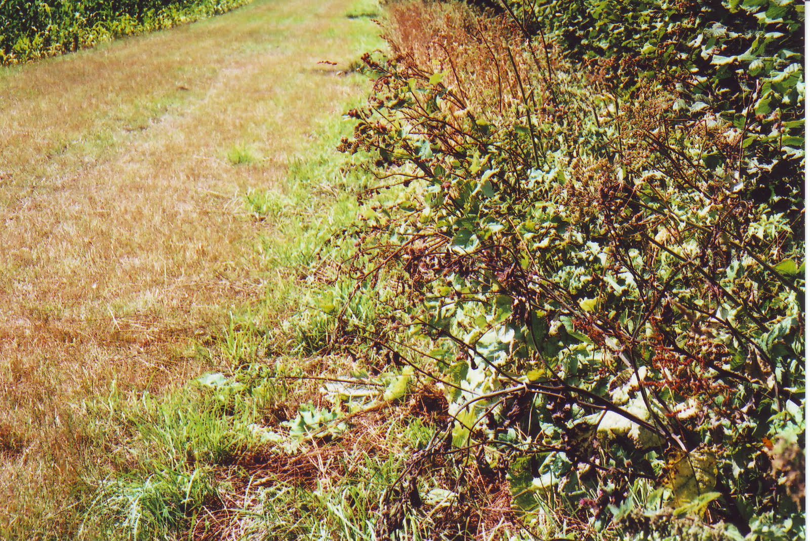

For a short stretch, about halfway along the edge of the Wood, the O.S. recorded 'Free Border'. Perhaps this was the reason for there being at ST 686 173, where a footpath up from Purse Caundle's Manor Farm continues down into the woodland, there being just inside the woodland a large upright thin roughly rectangular stone which could well have been a boundary stone (seen in the centre of photograph).

This is another view of the stone, looking out from the wood into the adjoining field.


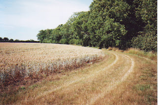


 Further along, the shared Shire boundary with Milborne Port parish finishes, and commences with that of Goathill parish (ST 681 167, Bench Mark 380.0 feet). Thus though not strictly part of the Purse Caundle Shire Boundary, shown here is a boundary stone between the parishes of Milborne Port and Goathill, situated just inside a field on the south-western edge of Hanover Wood, at ST 678 168.


The woodland (and boundary) at this hedgeline projects slightly out into the field, which accounts for the curvature in this photograph.


This photograph is looking southwards from an opening in a cross hedge towards Muse Hill woodland, through which the boundary progresses. Note the observation platform on the right, this being hunting country.

The above photograph is the view from the entrance to Muse Hill woodland, back to the point from which the previous photograph had been taken.

This O.S. map section follows the final part of the county boundary through Muse Hill woodland and down to a boundary stream.
This following section of the old Shire Boundary is shared between Purse Caundle and Goathill, for until 1880 the latter was part of Somerset, at which date it was transferred to Dorset. This section was covered by O.S. 26/9430 (Somerset No. 11093). The respective meresmen being Henry Harris overseer for Purse Caundle and Elias Lawrence for Goathill. This view is looking backwards (north) along the eastern edge of Hanover Wood, taken from where the boundary meets another piece of woodland - Muse Hill (ST 678 166). Elias Lawrence was to make the usual statement: 'Property Right. The Owners of Hedges, Banks, and claim six feet space into thr adjoining lands and they - the Owners - can appropriate this space to any purpose they choose; walls are however as a rule built to the extent of property.

This the entrance to Muse Hill woodland. 'Muse' could well be a corrupted spelling of 'Mews', the name of early occupiers of Purse Caundle manor house.


The boundary descent continues until it reaches the point in the next photograph.


A short distance down is a gap in the hedge. The hedge then continues with a ditch running along its middle, which could have been the original boundary. This ditch can just be discernible in this photograph.


The old Purse Caundle-Somerset boundary ends at this stream, which now on its western length forms a boundary between Goathill and Haydon; whilst to the east it forms for a few yards the boundary between Purse Caundle and Haydon before running as a boundary between two Purse Caundle fields.


As already noted, in the Goathill side of the hedge is something of a ditch. This photograph was taken from the Purse Caundle side of the hedge, showing the ditch through the hedge.
Having reached the end of what was the joint county boundary between Dorset and Somerset, we now start a purely inter-parish one - see 1B below.
It will have been noticed that the bulk of the eastern and northern county boundary follows more or less maximum high contour lines, giving Somerset fine views overlooking open Dorset landscape. However, the majority of the western north-south section gives Dorset the high ground overlooking wooded Somerset.
Whilst probable Shire boundary markings such as standing stones and walls have been noted, the dates of their placement are not known.
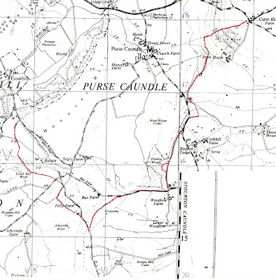
Since the date of formation of the parish of Purse Caundle is unknown, the reasons for the particular line of its boundary will probably never be known, though as with that of the county boundary, following the line of one or more contours cannot be ruled out. It must be remembered that although county boundaries were defined in Anglo-Saxon times, Purse Caundle as a separate parish was seemingly only first recorded in the 12th century. Before that time - certainly at the time of Domesday - it was part of a larger undefined area known as CANDEL. The parish as such could well have been formed to cover the area(s) of its monastic Manor(s).
 The purely Parish Boundary between Purse Caundle and Haydon was dealt with in O.S. 26/2932 (County of Dorset No. 12564), with the respective meresmen being Henry Harris for Purse Caundle, and George Gosney for Haydon (who had to make his 'X' mark). Henry Harris made the usual declaration of: 'Property Right. The Owners of Hedges Banks &c. claim 4 feet space into the adjoining lands as their property. And they (the owners) can appropriate this space for any purpose they choose. Walls are however as a rule built up to the extent of property.' This four feet claim is at variance with the six feet claimed by adjoining parishes.
Having reached the end of what was the joint county boundary between Dorset and Somerset, we now start a purely inter-parish one - see 1B below.
It will have been noticed that the bulk of the eastern and northern county boundary follows more or less maximum high contour lines, giving Somerset fine views overlooking open Dorset landscape. However, the majority of the western north-south section gives Dorset the high ground overlooking wooded Somerset.
Whilst probable Shire boundary markings such as standing stones and walls have been noted, the dates of their placement are not known.
1B - PURSE CAUNDLE INTER-PARISH BOUNDARY

Since the date of formation of the parish of Purse Caundle is unknown, the reasons for the particular line of its boundary will probably never be known, though as with that of the county boundary, following the line of one or more contours cannot be ruled out. It must be remembered that although county boundaries were defined in Anglo-Saxon times, Purse Caundle as a separate parish was seemingly only first recorded in the 12th century. Before that time - certainly at the time of Domesday - it was part of a larger undefined area known as CANDEL. The parish as such could well have been formed to cover the area(s) of its monastic Manor(s).


Where once maps showed a footbridge across the stream, there is now this form of stepping stones, though on both banks barbed wire blocks access. This photograph was taken from the Purse Caundle bank.

After leaving the stream's foot-crossing from the southern bank, the parish boundary progresses in a right-hand curve across a field (still acting as a boundary between two fields in 1903) to the northern-most corner of Coach Hill Wood. In the 1880s there was apparently a hedge between these two points, but since grubbed up with the route now what would be termed 'Defaced'. The O.S. recorded '4 ft Root of Hedge' on the Haydon side.
The boundary then proceeded up an incline, first along the north-east facing edge of woodland, then along south-west facing edge of other woodland, with O.S. recording '4 ft Root of Hedge' on the Purse Caundle side.

The boundary then goes away to the left (south-eastwards) of the above photograph, along the north-east facing edge of Coach Hill Wood, to a hedge at the far end of the field. O.S. now recorded '4 ft Root of Hedge' on the Haydon (woodland) side.
The boundary goes through the hedge and along another hedgeline until at ST 683 158 it meets with the road going down to Allweston, with O.S. recording '4 ft Root of Hedge' along the Purse Caundle side.
It crosses the road, then for a short distance across the northern tip of a field and meeting at ST 684 157 (approx. Bench Mark 290 feet) the road down to Bishops Caundle.
For a few metres the boundary runs eastwards along the southerly side of this road, before going through a right-angle turn southwards.
After some distance it does another right-angle turn at ST 683 155, going south-eastwards almost parallel with the Bishops Caundle road (behind Folly Farm which was not on the 1903 map). All the while the O.S. still recorded '4 ft Root of Hedge' on the Purse Caundle side. At the point of this latest turn the Purse Caundle met up with the Caundle Marsh parish boundary whose meresman was James Parsons. This zig-zagging may well follow the same pattern as earlier seen in the vicinity of Gospel Ash farm.
The boundary then again meets the Bishops Caundle road at a southerly bend in the latter, ST 686 153, Bench Mark 391 feet, and runs along the road's southerly side, again '4ft Root of Hedge' on the Purse Caundle side.

At ST 692 155 the boundary reaches Rue Lane.
The boundary then proceeds eastwards along the 'Centre of Road', with after a while having Plumley Wood on the north Purse Caundle side.

At the south-east corner of Plumley Wood, the boundary turns north along the Wood's eastern edge, reverting to '4 ft 6 ins Root of Hedge' on the eastern Stourton Caundle side.
Beginning at ST 698 158 there begins an anomaly in that there is at first thought an unexplained curved indentation into the Wood which the boundary follows, and ends at ST 699 161. But study of an old O.S. map shows that this eastern edge of woodland - including the indentation - is parallel to the 400 ft contour which runs just inside the woodland itself.


The boundary turns sharp east at ST 702 166, going up a roadside embankment and eastwards along a field hedge, with '4 ft Root of Hedge' on the south Stourton Caundle side. The hedge is on a low ridge.


At the junction between these two parishes is this ash tree.


The only known surviving Anglo-Saxon land charter having any connection with Purse Caundle is that granted by King Athelstan to Sherborne Monastery on 26 January 933. This land was in what is now Stalbridge Weston and Stalbridge. Cyril Hart in DNHAS, Volume 86, 1964, was able to follow the probable bounds. The first relevant charter point was "north along the enclosure to Beornred's pasture" which Hart considered to be on the banks of the stream at about ST 701 170, i.e. in this area, but which was not seen during this perambulation.


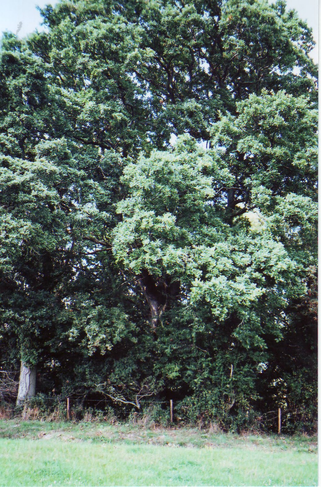


The edge of the remaining woodland then bears a little leftwards at a field hedgeline on the east/right-hand side, the '4 ft 6 in Root of Hedge' now being outside the woodland on the Stalbridge side. There was only one further relevant charter bound record "on to the high Wifel's Hill", which Hart considered to be Copse House Farm at ST 710 180 - see below.
At the end of the woodland a joint field hedge runs northwards until it meets up at a T-junction (ST 703 177, height 105 metres) with a footpath from Manor Farm running SW-NE. The '4 ft 6 in Root of Hedge' for this short stretch of hedge is on the Purse Caundle side.
The boundary then follows the footpath north-eastwards until it meets the northern edge of Frith Wood (at the point where the 400 foot contour line crosses). The '4 ft 6 in Root of Hedge' for this short section is on the Stalbridge side.


The footpath (but not the boundary) then currently makes a southwards detour around Frith Cottages which have been confirmed as being in Stalbridge parish. This is a photograph taken at the point of detour, showing the steps and gateway of the continuing footpath.


A few yards short of the road hedgeline the defaced boundary turns southwards across to the other side of the entrance driveway to Frith Cottages which are in Stalbridge parish.

The boundary then crosses the Stalbridge Weston Road, to the southern corner of its junction with the road down to Copse House and Stalbridge, at ST 709 180. It was at this corner that the inter-county boundary perambulation began - as at the beginning of this Chapter.
1C - PURSE CAUNDLE MANOR BOUNDARY/(IES)
The Manor boundary is more uncertain to determine, but to all intents and purposes coincided with that of the Parish. It was suggested earlier that the converse may have been the case, with the Parish following the boundary of the Manor(s). The difficulty arises with there being the two original Manors of Athelney and Shaftesbury, which were joined together after the Dissolution, but were apparently considered separated at a later undetermined date.
The earliest known manorial estate map is from about 1780, being possibly compiled at the time Francis Earl Brooke and Earl of Warwick sold the Lordship and manor estate to Sir Richard Hoare. The estate as such seemingly did not by then contain the manor house or adjoining Purse Caundle Farm (Home Farm) and its land. A subsequent map of 1785 for Richard Colt Hoare equally showed the same lack. But what Lordship jurisdiction there still was over these two properties is again not certain. See APPENDIX A1 for fuller discussion on this whole latter aspect.
A 'Map of the Manor of Purse Caundle' (WSRO ref: 3117/4), said to be dated c.1810, contains the whole parish/village. which appears at first glance to substantiate that all three units were totally coincident. But the 1838 Tithe Map again shows a separation between the Manlor Lordship and the manor house with its Home Farm. So between the Tudor grant of the two abbeys' Lordship Manors to the Stourtons and the 1780 estate map, there appears to have been a selling-off of what had been originally the Shaftesbury abbey Manor.
From 1559 any perambulation or 'beating' of the bounds of parishes, etc., apparently became obligatory. At Purse Caundle Manor it was certainly carried out prior to 1590, as witness the Steward's instruction to the Manor Court on 18th September 1590 (see CHAPTER 5). But unfortunately no record of any such "view of the bounds" appears to have survived; and that particular Court instruction is the only reference to a perambulation in known surviving Purse Caundle Manor Court records. With the general introduction of estate maps from the mid-eighteenth century, due to improvement in surveying techniques, such perambulations were to a certain extent to become unnecessary.
- - - - - - - - - - - -
This whole topic of Boundaries is so complex, and research still ongoing, that its complete writing-up is being prolonged for a while.
For those able to attend at the Dorset County Museum this coming Saturday, 23rd October, at 9.30 a.m., there is a Symposium organised by the Dorset Boundary Survey Group, when there will be throughout the day a series of presentations by members of the Group (but not including this author, who hopes in any case to bring along a ring-binder of this total up-dated Post). The cost for the day - including refreshments and lunch - is £
For those able to attend at the Dorset County Museum this coming Saturday, 23rd October, at 9.30 a.m., there is a Symposium organised by the Dorset Boundary Survey Group, when there will be throughout the day a series of presentations by members of the Group (but not including this author, who hopes in any case to bring along a ring-binder of this total up-dated Post). The cost for the day - including refreshments and lunch - is £
To be continued ....................
Subscribe to:
Posts (Atom)