Tuesday, November 10, 2009

PURSE CAUNDLE HISTORY - CHAPTER 1: TOPOGRAPHY - 1: BOUNDARIES

Updated: 27th October 2010, 16.20 p.m.

Something of a panoramic view of the Purse Caundle vale, as seen from Rue Lane, O.S. Grid ref: ST 693 156. Hanover Wood is on the extreme top left-hand side, and Wood House Covert on the right-hand side. Along the distant skyline is the Purse Caundle northernmost section of the Dorset-Somerset boundary.
- - - - -- - - - - - - - - - - - 

'This fertile and sheltered tract of country in which the fields are never brown and the springs never dry.' Thomas Hardy

Other similar sentiments expressed have been:
'. . . the beautiful Vale of Blackmore, an engirdled and secluded region.'
'. . . the prospect is a broad rich mass of grass and trees, mantling minor hills and dales within the major.'

  The parish of Purse Caundle is in the far north-west of Dorset, just on the northern edge of Blackmore Vale, being within a little vale of its own. It is bounded on three sides (west, north and north-east) by the county of Somerset, being almost midway between Milborne Port to the west and Henstridge to the north-east, which are both in Somerset. Further to the west is Sherborne (Dorset) some four miles distant, and Stalbridge (Dorset) some 3 miles eastwards; whilst southwards are Stourton Caundle and Bishops Caundle.
  The parish lies in the broad valley of a small tributary of the River Yeo - the Caundle Brook.The land rises from about the 70 ft above sea-level in the area of the church to just over 350 ft in the north-west, and in both the south-east and north-east to about 450 ft. The village itself lies roughly near the centre of the parish, and appears to have grown up arpund the stream there.
  In 1874, when the official Ordnance Survey parish boundary perambulation was undertaken, the acreage was stated as being 1,470, with a circumference of 1 1/4 miles.
  The present parish, covering some 1,588 acres, straddles the 18th century London-Exeter turnpike A30 road, though only Raghill cottages and the later built hamlet of Crendle with some fields and woodland lie on the north side of this road. The main somewhat compact part of the village lies 1/4 mile south of the road, with two old outlying farms and two houses southwards.
  There have been several full and partial Dorset county maps which have depicted Purse Caundle (in various spellings). Firstly, there is Gough's somewhat primitive map of Britain, c.1300, with un-named towns just depicted as black spots. Then c.1570 was the map of north-west Dorset (British Library ref: Add. Mss 52522) which showed 'Mr Hatton' as Lord of Purse Caundle (which is confirmed in APPENDIX A1). A full description and review of  this map was given in 'An Elizabethan Map of North-West Dorset: Sherborne, Yetminster and Surrounding Manors' by Katherine Barker, in Maps and History in South-West England, 1991. Then came Christopher Saxton's county map in 1575 (see\detail); John Speed's in 1610; an unatributed one in 1645 (see detail); John Ogilby's road maps of 1656 (see detail); London bookseller John Wilcox's c.1732, dedicated to the 'Honourable George Dodington Esq.; Isaac Taylor's in 1765 (see detail); the Manor Estate 'Survey of Purse Caundle belonging to the Right Honble Francis Earl Brooke and Earl of Warwick' c.1780; Robert Colt Hoare's estate map of the Manor of Purse Caundle in 1785; two unatributed Manor estate maps c.1810; and the Purse Caundle Tithe Map of 1838.
  Maps became more detailed with the advent of the Ordnance Survey in the early 19th century. It is interesting to compare early pre- and post-railway 1 inch maps (see details). End of 19th century 6 inch maps are naturally more detailed. In the 21st century aerial, and 3-D ground level panoramic visual images are becoming easily and freely available on the internet.
  Illustrated are appropriate sections of a 1903 edition of an Ordnance Survey six-inch scale map of Purse Caundle (with acknowledgements to the Ordnance Survey). For 21st century conditions readers should refer to the Ordnance Survey Explorer 129 map - Yeovil & Sherborne.

1. - COUNTY, PARISH, AND MANOR BOUNDARIES
  From information derived from the above, a boundary line around the parish/Manor can be determined - in theory and on paper that is. The difficulty is in accurately ascertaining it on the ground, and with what permanent boundary markers there may have been, and what are still in situ. The various county and parish boundaries may well have been marked out in diferent fashions, depending on such aspects as terrain, and what was already in existence that could have been utilised. The earliest boundary in this instance can be assumed to have been the county boundary between Dorset and Somerset, but unfortunately there seems to be no extant Anglo-Saxon charter, etc. setting this original joint-county boundary. It is worth noting that the first so-far known mention of 'Dorset' was in 845 (though neighbouring Hampshire was first mentioned in 757). James Campbell in The History of the English Shires wrote 'though there are reasons for supposing that [they] may be a century or more older.'
  The subject and history of boundaries has thankfully been well-covered by Maurice Beresford in his History on the Ground. One could be tempted into reprinting much of this verbatim in this Purse Caundle History, but must perforce only necessarily use it as it may relate to Purse Caundle. As quoted by Beresford, the use of asn old Saxon boundary charter from its inception would have been referred to in order to settle a dispute. For instance, in 896, in the Cotswolds, a claimant was ordered by the Witan:
'to ride out with the priest of the people of  'X' . . . along all the boundaries as he read them from the old books [i.e.charters].'
  Not so many places have surviving documents as early as this, yet firm boundaries must have been established with thir position handed down orally from generation to generation. This would have been reinforced sometimes by perambulations of the bounds, and later in medieval times by their enrolment in manor court records.

1A - PURSE CAUNDLE'S DORSET-SOMERSET COUNTY BOUNDARY

  This author had already to a certain extent perambulated most of this inter-county boundary before joining a similar exercise by the Dorset County Boundary Survey Group on 3rd June 2009. On this occasion all but the final south-west 1200 metre section was traversed. The current O.S. Explorer 129 and British Geological Survey 'Shaftesbury' maps were used, together with early large scale O.S. maps.
  During 1883-1884 Ordnance Survey Royal Engineers (R.E.) staff undertook parish boundary perambulations in collaboration with the respective parishs' meresmen. Tithe maps from the 1830s were used as the basis for determining the official boundaries. Any discrepancies, differences, etc. were to be mutually agreed. The R.E. staff drew annotated sketch plans in special notebooks, which were later deposited with the National Archives under shelf-mark OS 26, with each notebook being given its own individual identification number - as will be shown below. The notations included such comments as to whether the boundary was hedge, wall or stream; and how distant from a hedge bottom was the boundary. Having noted the contents of the relevant O.S. 26 notebooks, this writer has undertaken final perambulations of all Purse Caundle bounds, taking photographs along the way. These show not only the view forward, but sometimes also views backwards.
  These R.E. perambulations were generally carried out in a clockwise direction, but for personal reasons this writer preferred to travel anti-clockwise.

  This O.S. map section shows the first part of the perambulation, starting from the road junction at Copse House Farm and procceding in a north-westerly direction to the A30 road at Toomers Hill.

   The eastern end of this Purse Caundle section of the inter-county boundary starts as above at the junction of Landshire Lane (going off to the left/east) and the road to Stalbridge Weston (seen going off to the right/south), close to Copse House (O.S. Grid ref: ST 709 180, Bench Mark 455.5 feet). The boundary starts at the right-hand (southern) corner of Landshire Lane. Landshire is a frequent self-explanatory name denoting that land which defines the shire - and in this instance the boundary between the two parishes of Henstridge in Somerset and Stalbridge in Dorset.

 This junction is immediately opposite the end of the Purse Caundle parish boundary with Stalbridge (Weston) - as described in section 1B. The photograph above shows the view in the opposite direction of the previous one, and the start of the anti-clockwise county boundary perambulation.The boundary between Purse Caundle and Henstridge was mutually agreed with the respective Meresmen: Henry Harris and Josiah Pickford. The latter made a special declaration: 'Property Right. The owners of hedges, banks etc in the Parish of Henstridge claim six feet into adjoining land as their property and they the owners can appropriate this six feet space to any purpose they choose.'

Proceeding from the Landshire Lane junction north-westwards along the Stalbridge Weston road, for a total of some 330 yards, as per notebook OS 26/9365 (County of Somerset No. 9904 -Henstridge) pages 18-23, on the north side there is a dry-stone wall, some four feet high. The first section is now hidden by a hedge, but still visible. The road-facing side of the wall is the boundary. The stone to build this wall could well have come from a quarry a little way along Landshire Lane seen above. The corner hedge on the left is at the end of the aforementioned boundary between Purse Caundle and Stalbridge Weston.

   About halfway along the wall had been breached in recent years for the building of a house.

 This is the continuation of the house wall, and then resumption of the original boundary wall, again behind the hedge.
 This section of wall ends at two field gates, the second of which is where the boundary then turns more northwards - ST 707182. (Only a few yards further westwards along the road, on the south side, the Ordnance Survey has erected one of their trigonometric concrete markers at height 141 metres).

                                       
  This is a view from the above gateway, showing the boundary wall (initially obscured by foliage) on the right, which now continues for a total of about 1,100 yards across farmland and through coppice, with firstly a strip of coppice part of the way along the eastern (Somerset) side of the wall.

                                  
  The actual boundary was preliminary recorded by O.S. as being 'Foot of Wall', with the 'Halter Path' recorded as being '15ft wide from face of wall'. But the boundary was later to be defined as '15ft Face of Wall'. The boundary proceeds straight from the road gateway for some 150 yards before turning slightly leftwards, and then a further 75 yards to a field gateway across the pathway (ST 705 184). The adjoining coppice then continues for another 120 yards, ending almost at a field gateway within the wall. 

                                   
   After the coppice ends, the wall continues, with a break for a field gate. About five yards past this gateway, alongside the wall on the Purse Caundle side is a large recumbent dark stone (?similar to granite), which for size and characteristics does not appear to have been part of the wall. Was this a pre-wall boundary marker? A £2 coin is used to give some indication of size - though approximate dimensions are shown on the sketch below.
                                     
  The wall continues from the above stone for some 100 yards until it reaches a gateway into a strip of woodland through which the bridleway continues, as does the wall alongside on the eastern (Somerset) side. The boundary was still being recorded as '15ft Face of Wall'.

 This is a view backwards through the woodland to the entrance gateway. This woodland could be of only recent growth, as in 1883 the Purse Caundle side of the wall at this point was recorded as being 'Firs'. This path/track is classified as a 'Green Lane'.

                                       
  This early section of the pathway forward through the coppice, as can be seen,  is inclined to be somewhat muddy and overgrown, with stones from the boundary wall on the right/east now being used as paving.

  This is another backward glance along the woodland path, with the boundary wall clearly visible on the left (eastern) side. Because of the '15ft Face of Wall' notation, Ordnance Survey maps show the boundary as westward of the pathway - here on the right-hand side.

  This is another backward view further along the path, passing by the first of two aerial mast compounds. This mast was built to resemble a tree - and which is similarly liable to shed a twig!  

This is another backward glance further along the path, passing-by the second mobile phone aerial mast compound, again with the boundary wall on the left/east.

                                   
It is at this point that the wall ends at a field gateway, and where the woodland widens out eastwards to encompass an old quarry. This is a view back from the gateway along the Somerset side of the boundary wall. In 1883 the field was recorded as being 'Furze'.

                                  
From this point the boundary - being now on the brow of Toomer Hill - was recorded as 'Defaced for 300 ft(?)' by the O.S. in 1883. This may have been so caused by the early opening of the quarry for building the wall - both being in Somerset. It thus continues in the same straight line, passing to the west of the now disused quarry, (its stratafied face just visible on the extreme right of the photograph), across the A30 main road (ST 702 191, Bench Mark 452 feet), and still 'Defaced' up and over a coppice bank to the beginning of the Old Road which dates from at least medieval times.
  Somewhere at this point the O.S. recorded there being 'Boundary Posts', but as they are no longer in existence, and what their exact position was it is not known, and neither whether they were erected by Dorset or Somerset County Councils. See a more positive explanation at Crundle Corner below.


  This O.S. map section covers the county boundary from Toomers Hill westwards to Crendle (or Crundle) Wood. 

                                   
Once onto the 'Old Road', the boundary proceeds westwards along its north side a few yards until a gateway is reached - just visible in left-hand top corner.

                                    
The boundary then turns northward through the gateway (ST 702 191) into private woodland - Brownshill Copse, where there is no public right of way. The Dorset County Boundary Survey had to request permission to perambulate through it.

 The boundary proceeds along a pathway at the foot of a wooded escarpment. In 1883 the O.S. records '6 ft Root of Hedge' on the Purse Caundle side, but no such hedging is now visible; whilst by 1928 the O.S. record says 'Top of Bank' (which would be up on the right-hand side). This is now the start of the shared boundary between Purse Caundle and Milborne Port parishes, covered in OS 26/9424 (County of Somerset No. 10935), pages 13-19, 32-34, 39 and 42.  The meresmen were Henry Harris overseer for Purse Caundle, and Joseph Hyde rate collector for Milborne Port. The latter made a written 'Property Right. The Owners of Hedges, Banks &c., claim Six feet space into the adjoining lands, and they thr owners - can appropriate this space to any purpose they choose walls are however as a rule built to the extent of property.'
  This is the view back southwards along the track, taken from the start of a supposed boundary ditch - see next photograph.

  At ST 701 192, something of a shallow ditch starts to run off westwards from the track, seemingly along the line of the boundary, until it reaches the western open edge of the woodland at ST 698 191, though the Ordnance Survey records this section of the boundary as 'Defaced'.

                                        
This shows a continuation westwards of the boundary ditch.

A further continuation downwards along the boundary ditch.
Nearing the end of the boundary section of the ditch.

                                    
The end of the boundary section of the ditch at ST 701 192, as the boundary now turns up to the right (northwards) along the edge of the woodland.

                                      
This photograph shown a view at ST 701 192 backwards along the boundary ditch inside the woodland.
  The boundary then turns sharply to run northwards for about 50 metres along the edge of the wood (which seemingly was not in existence in 1883, except for perhaps a very narrow boundary strip) and field  until reaching a gateway back into the now woodland at ST 698 192. Again the boundary is recorded as '6 ft Root of Hedge' on the Milborne Port side inside the copse.
                                        
  The boundary then runs 'Defaced' in a gentle left-hand curve across four fields to just below Gospel Ash Farm. This photograph shows the south-westerly route of the boundary line acrss the first field to near the left-hand corner where it goes through a hedge.

                                     
This is the view backwards along the 'Defaced' boundary across this first field to the woodland gate with the previous distant section along the edge of the woodland running away to the right. It would be of interest to learn the reason for these seemingly erratic boundary directions in this vicinity; but Maurice Beresford in his book, pages 44-45 was of the opinion that "bounds which make a large number of small right-angled turns and returns within a short distance . . . On the edge of a parish these small clearances will probable be the final act in the conquest of the forest, . . ."

  The boundary continues to run 'Defaced' across the second field to within a few metres of the south-west corner. Here is goes those few metres south to the entrance into the third field 
  The boundary continues westwards along the hedgeline parallel with the Old Road, until it reaches the fourth field.
  At the far western end of the fourth field the 'Defaced' boundary comes to a gateway onto and crosses the tarmaced driveway which leads to Gospel Ash farm to the north.


   This is a view of the present Gospel Ash tree at ST 692 188, looking westwards from the farm driveway, and onwards along the 'Defaced' boundary route. There are two supposed explanations for this tree being so named as will be seen in CHAPTERS 5 and 7. Ash trees were often used as boundary markers, their use being derived from the Anglo-Saxon god Woden who received a message from the runes of the ash tree. An ash tree could live up to a 1,000 years, with each tree differing in its bark structure. Boundary trees would often be planted on natural or man-made mounds or banks.

                             
After a short distance across the open field the 'Defaced' boundary then meets with a stream which flows N-S. For a few yards the boundary follows the eastern bank of the stream northwards at ST 691 189. This photographs is looking eastwards across the stream to the boundary on the opposite bank.

  This photograph shows the point at which the boundary ceases to follow the stream and turns sharp left to follow a hedgeline westwards.

  The boundary follows the other (northern) side of the right-hand hedgeline to the far end of the field, which O.S. records as '6ft Root of Hedge'.
  At the far end of the field hedge the boundary makes a small kink northwards along the field hedgeline before continuing 'Defaced' south-westwards across a final field. 
It eventually reaches the first few metres of a Green Lane going north-westwards, at its junction with the now still original surfaced Old Road (now classed as an Occupation Road) which goes away south-westwards down to Milborne Port, and the pathway going southwards through Crendle Wood. This point is at ST 687 188, contour height 115 metres. This is the view from this point backwards along the 'Defaced' boundary across a field and eventually to Gospel Ash Farm visible in the centre background.  
There was a deal of discussion by O.S. at the time as to the correct route of the boundary at this junction. As well as the two meresmen, other interested parties were consulted by the O.S. On the westward side of the Green Lane, on top of the embankment looking down onto the Old Road to Milborne Port is this old boundary stone, which the O.S. considered to have been placed on the wrong side of the Green Lane. This view of the stone is taken from below, on the escarpment slope.


  This O.S. map section follows the county boundary southwards down through Crendle Wood to Crundle Corner, Bench Mark 235.4 feet.

                               
  This photograph was taken from close to the boundary stone, looking forward across the Old Road to the boundary's entrance through a gateway into Crendle Wood.

                                  
  The boundary now runs through this gateway and southwards for a total of about 900 yards down through Crendle Wood to the A30 road at Crendle Corner. Firstly it runs along the top of an escarpment which faces westwards into Somerset. The O.S. however records '6 ft Root of Hedge' along the Somerset side of this route, with woodland only this same side and not like now also on the Dorset side.

                              
  Further down through Crendle Wood, clearly showing the ditch and escarpment to the (Somerset) right-hand.

                                   
  Further down still along the boundary escarpment.


  Quite a way down through Crendle Wood, the track turns into a serpentine path, when the boundary then starts to run along the Somerset side of a hedgeline on the left-hand side of the woodland, through a disused quarry, then for a few meters on the Dorset side of another field's hedgeline until it meets up again with the N-S stream met with earlier up near Gospel Ash.

                                  
The boundary is defined as 'Face of Wall' of a bridge over the stream.
  The boundary follows the stream down to the A30 road at Crendle Corner at ST 691 182, contour height 80 metres. It was agreed with the O.S. that the stream is wholly within Dorset, with the boundary running along its western bank. 
  Here at Crendle Corner rhe boundary stream runs through a culvert under the A30 road, with the boundary 'Centre of Stream', before reverting to being wholly in Dorset. Whilst not noticable in this instance, at other locations when a road crosses a county boundary the road itself can visibly change construction and/or colour according to the respective county's requirements. Similarly, such constructions as walls can occasionally show a clear demarcation at the boundary point.

                                 
  This is the boundary stream emerging from the road culvert, and starting its meandering to the base of Hanover Wood.
A few yards west past the culvert are these two derelict posts. Being on the Somerset side of the stream they would presumably have borne a SOMERSET County Council boundary sign, noted on older O.S. maps as 'Boundary Posts' or 'BPs'.
This is the first section of the stream through the field, taken on the western (Somerset) side, hidden by nettles and other low foliage.

                                          
The stream next becomes open, and trampled by cows.

                                    
The stream here turns eastwards.

                                      
The stream now becomes somewhat overshadowed by foliage.

Whilst still somewhat overgrown, the stream is now to do a right-hand turn.

                                        
The stream here has another stream joining it which comes from Purse Caundle village centre.

 The county boundary now leaves the stream which continues along the western edge of Hanover Wood. The boundary meanders for a short distance through a field to the base of Hanover Wood, being O.S. recorded as '6 ft Root of Hedge' on the Somerset side.


  This O.S. map section follows the county boundary down southwards along the eastern edge of Hanover Wood.
  The boundary leaves the stream and then skirts around the northern edge of Hanover Wood, up to ST 690 180, contour height 100 metres.

 This is the start of the boundary's run south-westerly along Hanover Wood's eastern edge. It now becomes '15 ft Root of Hedge' on the Purse Caundle (eastern) side.
  This next photo is taken at the gap in the cross hedge (ST 689 178) just seen in the far left-hand distance on the previous one.

  This is some 100 yards further along at the point where the woodland boundary takes something of a right turn.

  At this point the boundary straightens out again, with a second cross hedge in the distance.


  This photograph was taken at the gateway through the cross hedge seen in the previous one at ST 687 176, at Bench Mark 348.7 feet.


  Here one has to make a slight detour from the boundary around a patch of waste weeded ground, with the following photograph showing a later backwards view.

  This is the view back northwards from the southern end of the waste weeded patch in the previous photograph.


  It will be noted that the photograph below was taken just before the bend to the left in the previous one.


 It is noted that this eastern edge of Hanover Wood runs roughly parallel to the 300 ft contour which is just inside the woodland.
  Along the stretch of boundary in the previous photograph is this signpost

 
  Along the stretch of boundary in the previous photograph is this signpost.
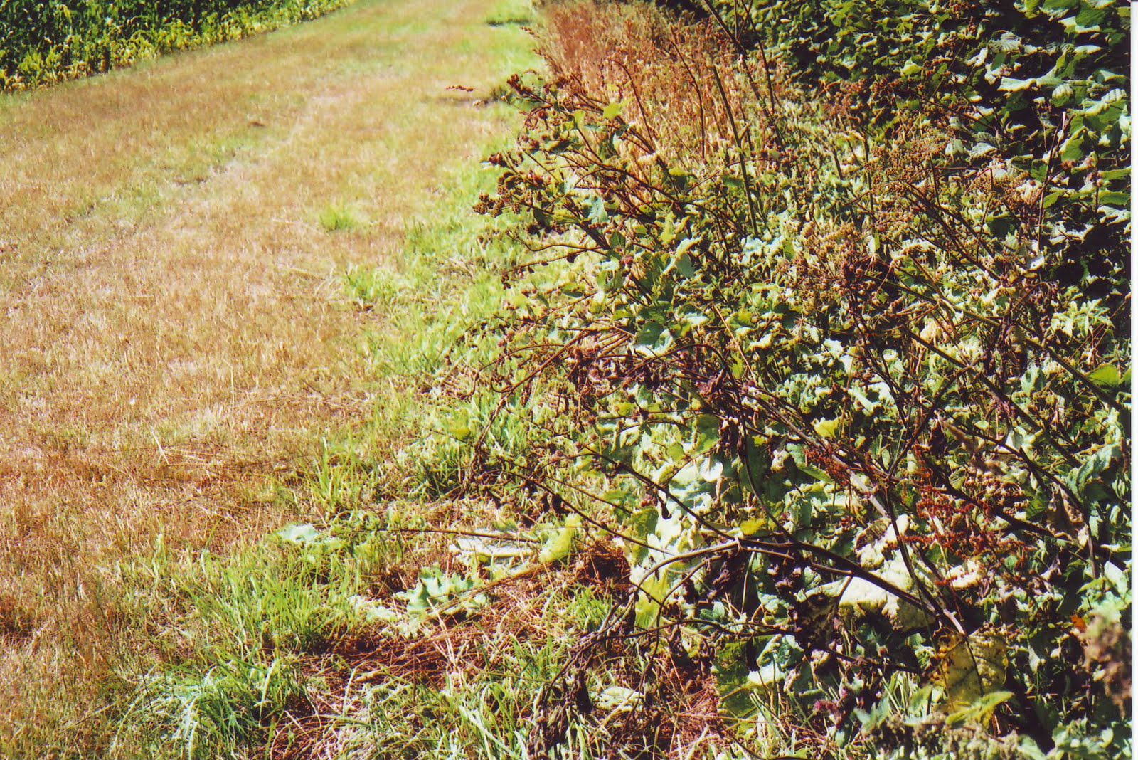

                                    
  For a short stretch, about halfway along the edge of the Wood, the O.S. recorded 'Free Border'. Perhaps this was the reason for there being at ST 686 173, where a footpath up from Purse Caundle's Manor Farm continues down into the woodland, there being just inside the woodland a large upright thin roughly rectangular stone which could well have been a boundary stone (seen in the centre of photograph).

  This is another view of the stone, looking out from the wood into the adjoining field.


  The woodland (and boundary) at this hedgeline projects slightly out into the field, which accounts for the curvature in this photograph.


  Further along, the shared Shire boundary with Milborne Port parish finishes, and commences with that of Goathill parish (ST 681 167, Bench Mark 380.0 feet). Thus though not strictly part of the Purse Caundle Shire Boundary, shown here is a boundary stone between the parishes of Milborne Port and Goathill, situated just inside a field on the south-western edge of Hanover Wood, at ST 678 168.

  This photograph is looking southwards from an opening in a cross hedge towards Muse Hill woodland, through which the boundary progresses. Note the observation platform on the right, this being hunting country.

  The above photograph is the view from the entrance to Muse Hill woodland, back to the point from which the previous photograph had been taken. 

  This O.S. map section follows the final part of the county boundary through Muse Hill woodland and down to a boundary stream.
   This following section of the old Shire Boundary is shared between Purse Caundle and Goathill, for until 1880 the latter was part of Somerset, at which date it was transferred to Dorset. This section was covered by O.S. 26/9430 (Somerset No. 11093). The respective meresmen being Henry Harris overseer for Purse Caundle and Elias Lawrence for Goathill. This view is looking backwards (north) along the eastern edge of Hanover Wood, taken from where the boundary meets another piece of woodland - Muse Hill (ST 678 166). Elias Lawrence was to make the usual statement: 'Property Right. The Owners of Hedges, Banks, and claim six feet space into thr adjoining lands and they - the Owners - can appropriate this space to any purpose they choose; walls are however as a rule built to the extent of property.

  This the entrance to Muse Hill woodland. 'Muse' could well be a corrupted spelling of 'Mews', the name of early occupiers of Purse Caundle manor house.

  The boundary proceeds down through the woodland in the form of a depression or shallow ditch.

  On the Goathill side of the depression/ditch are a number of overgrown shaped stones which may have formed part of a wall.


  The boundary continues down a fairly straight steep decline.

The boundary progresses down the steep decline until it reaches the Goathill Road at ST 678 165. The boundary could be the slight depression just discernable running down the slope, as the O.S. reported '6ft Root of Hedge' on its Purse Caundle side, possibly relating to the vestiges of a hedge seen on the right-hand edge of the photograph.


 The boundary descent continues until it reaches the point in the  next photograph.

 This is the end of the boundary's progress through the Muse Hill woodland, with the Goathill Road visible across which it continues to and through the stile on the opposite side.

  This is the view along the Goathill Road up into into Dorset from Goathill - the white marker on the right-hand being on the boundary line.

  This is the view along the Goathill Road from Dorset down into Goathill - the white marker on the left-hand being on the boundary line.
  This is the stile on the boundary line, on the Goathill (old Somerset) side.

  This is the view back northwards through the stile seen in the previous photograph.
 This is the view southwards from the same point as the previous photograph, along the Goathill (old Somerset) side of the boundary hedge..
  A short distance down is a gap in the hedge. The hedge then continues with a ditch running along its middle, which could have been the original boundary. This ditch can just be discernible in this photograph.

  The boundary continues in a gentle left-hand curve.

  The end of the county boundary is now in sight.

  The old Purse Caundle-Somerset boundary ends at this stream, which now on its western length forms a boundary between Goathill and Haydon; whilst to the east it forms for a few yards the boundary between Purse Caundle and Haydon before running as a boundary between two Purse Caundle fields.

  On the other side of the previous noted stile the boundary hedge on the Purse Caundle/Dorset side runs in a slight gentle left-hand curve down to the stream at the bottom of the field. The O.S. records the boundary as '6 Ft Root of Hedge' on the Goathill side. This is the view along down the Dorset side of the hedge, with the stream running along the left-to-right hedgeline at the far end.

  As already noted, in the Goathill side of the hedge is something of a ditch. This photograph was taken from the Purse Caundle side of the hedge, showing the ditch through the hedge.
  Having reached the end of what was the joint county boundary between Dorset and Somerset, we now start a purely inter-parish one - see 1B below.
  It will have been noticed that the bulk of the eastern and northern county boundary follows more or less maximum  high contour lines, giving Somerset fine views overlooking open Dorset landscape. However, the majority of the western north-south section gives Dorset the high ground overlooking wooded Somerset.
  Whilst probable Shire boundary markings such as standing stones and walls have been noted, the dates of their placement are not known.
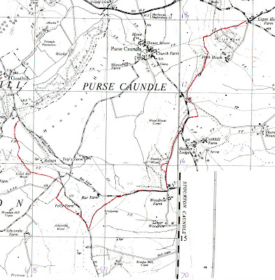

                                        1B - PURSE CAUNDLE INTER-PARISH BOUNDARY

  Since the date of formation of the parish of Purse Caundle is unknown, the reasons for the particular line of its boundary will probably never be known, though as with that of the county boundary, following the line of one or more contours cannot be ruled out. It must be remembered that although county boundaries were defined in Anglo-Saxon times, Purse Caundle as a separate parish was seemingly only first recorded in the 12th century. Before that time - certainly at the time of Domesday - it was part of a larger undefined area known as CANDEL. The parish as such could well have been formed to cover the area(s) of its monastic Manor(s).


  The purely Parish Boundary between Purse Caundle and Haydon was dealt with in O.S. 26/2932 (County of Dorset No. 12564), with the respective meresmen being Henry Harris for Purse Caundle, and George Gosney for Haydon (who had to make his 'X' mark). Henry Harris made the usual declaration of: 'Property Right. The Owners of Hedges Banks &c. claim 4 feet space into the adjoining lands as their property. And they (the owners) can appropriate this space for any purpose they choose. Walls are however as a rule built up to the extent of property.' This four feet claim is at variance with the six feet claimed by adjoining parishes.
  The parish boundary stream reached as part of the county boundary has hedging along both its banks. The parish boundary runs for a few metres south-easterly along the south (Goathill) bank of the stream, with the O.S. recording '6 ft Root of Hedge'. This is a view back westwards along the Purse Caundle bank

  Where once maps showed a footbridge across the stream, there is now this form of stepping stones, though on both banks barbed wire blocks access. This photograph was taken from the Purse Caundle bank.
  After leaving the stream's foot-crossing from the southern bank, the parish boundary progresses in a right-hand curve across a field (still acting as a boundary between two fields in 1903) to the northern-most corner of Coach Hill Wood. In the 1880s there was apparently a hedge between these two points, but since grubbed up with the route now what would be termed 'Defaced'. The O.S. recorded '4 ft Root of Hedge' on the Haydon side.
  The boundary then proceeded up an incline, first along the north-east facing edge of woodland, then along south-west facing edge of other woodland, with O.S. recording '4 ft Root of Hedge' on the Purse Caundle side.

  At ST 678 160 the boundary then leaves this woodland at a spot already known by 1883 as 'Dead Man's Stile' (apparently based on true historical fact). The owner/occupier of Tripps Farm reckons it derives from the time a man carried at sheep across his shoulders, which kicked and killed him at this spot. As will be seen from this photograph looking backwards into the woodland, any stile has since been replaced by a wooden gate.

  The boundary then goes away to the left (south-eastwards) of the above photograph, along the north-east facing edge of Coach Hill Wood, to a hedge at the far end of the field. O.S. now recorded '4 ft Root of Hedge' on the Haydon (woodland) side.

  The boundary goes through the hedge and along another hedgeline until at ST 683 158 it meets with the road going down to Allweston, with O.S. recording '4 ft Root of Hedge' along the Purse Caundle side.

  It crosses the road, then for a short distance across the northern tip of a field and meeting at ST 684 157 (approx. Bench Mark 290 feet) the road down to Bishops Caundle.

  For a few metres the boundary runs eastwards along the southerly side of this road, before going through a right-angle turn southwards.


  After some distance it does another right-angle turn at ST 683 155, going south-eastwards almost parallel with the Bishops Caundle road (behind Folly Farm which was not on the 1903 map). All the while the O.S. still recorded '4 ft Root of Hedge' on the Purse Caundle side. At the point of this latest turn the Purse Caundle met up with the Caundle Marsh parish boundary whose meresman was James Parsons. This zig-zagging may well follow the same pattern as earlier seen in the vicinity of Gospel Ash farm.


  The boundary then again meets the Bishops Caundle road at a southerly bend in the latter, ST 686 153, Bench Mark 391 feet, and runs along the road's southerly side, again '4ft Root of Hedge' on the Purse Caundle side.


  At ST 688 151 the boundary now meets with that of Stourton Caundle parish (O.S. 26/2905, County of Dorset No. 12178), whose meresman was M. F. Maggs, making his statement of 'Property Right. The owner of Hedges, Banks &c claim 4 ft 6 ins space into the adjoining lands & they (the owners) can appropriate this space for any purpose they choose. Walls are however as a rule built up to the extent of property.' The boundary now sweeps round north-eastwards in a gentle curve, with what looked like marshy ground on the north-westerly side, with '4 ft 6 ins Root of Hedge' northerly on the Purse Caundle side.


  At ST 692 155 the boundary reaches Rue Lane.


  The boundary then proceeds eastwards along the 'Centre of Road', with after a while having Plumley Wood on the north Purse Caundle side.


  At the south-east corner of Plumley Wood, the boundary turns north along the Wood's eastern edge, reverting to '4 ft 6 ins Root of Hedge' on the eastern Stourton Caundle side.


  Beginning at ST 698 158 there begins an anomaly in that there is at first thought an unexplained curved indentation into the Wood which the boundary follows, and ends at ST 699 161. But study of an old O.S. map shows that this eastern edge of woodland - including the indentation - is parallel to the 400 ft contour which runs just inside the woodland itself.

  At ST 701 165 (height 125 metres) the boundary  reaches Cockhill Lane (a little south of Clayhanger), along which it proceeds northwards for a short distance, with the boundary being 'Centre of Road'.


  The boundary turns sharp east at ST 702 166, going up a roadside embankment and eastwards along a field hedge, with '4 ft Root of Hedge' on the south Stourton Caundle side. The hedge is on a low ridge.

  Halfway along the hedge in the previous photograph this is the view northwards towards Purse Caundle village.

  The boundary then very shortly meets with the Stalbridge parish boundary (OS 26/2906, County of Dorset No. 12181). The meresman for Purse Caundle being again Henry Harris, and William Ryall for Stalbridge. William Ryall was to make the following usual style declaration: 'Property Right. The owners of Hedges, Banks to claim 4 ft 6 in space into the adjoining lands & they (the owners) can appropriate this space for any purpose they choose. Walls are however as a rule built up to the extent of property.'
  At the junction between these two parishes is this ash tree.

  This new boundary turns northwards, again along a hedgeline, skirting eastwards of Clayhanger. '4 ft 6 in Root of Hedge' marked on the Stalbridge side. The hedge lies over and along what could have been the original boundary ditch pictured above.


  It then meets with a gateway into this ancient greenway (approx Bench Mark 367 feet) along which it proceeds for a few yards north-westwards in 'Centre of Road', but does not reach its end where it joins Cockhill Lane at Bench Mark 328.6 feet.

  It now follows a footpath with another hedgeline (including a field gate), curving round to the north-east (following the 300 foot contour for a short distance), with '4 ft 6 in Root of Hedge' on the Purse Caundle side. This seems to be further zig-zagging to that noted previously.
  The only known surviving Anglo-Saxon land charter having any connection with Purse Caundle is that granted by King Athelstan to Sherborne Monastery on 26 January 933. This land was in what is now Stalbridge Weston and Stalbridge. Cyril Hart in DNHAS, Volume 86, 1964, was able to follow the probable bounds. The first relevant charter point was "north along the enclosure to Beornred's pasture" which Hart considered to be on the banks of the stream at about ST 701 170, i.e. in this area, but which was not seen during this perambulation.
  The O.S. boundary proceeds to the south-east corner of Doles Covert - seen at the far right-hand side.

 The charter said "to the great oak", which Hart considered to be this self-same spot at ST 703 173.

  The public footpath, and O.S. boundary continues along the eastern side of Dales Covert to the gateway seen on the far right, with '4 ft 6 in Root of Hedge' initially on the Purse Caundle side - inside the woodland.

  This gives some indication of the size of the oak tree on the boundary whose trunk can be seen in the previous photograph.

  This view along the footpath and boundary was taken from the gateway seen a couple of photographs previously.

  The joint footpath and boundary pass through the hedge in the distance.
  The Anglo-Saxon charter then said "along the hedge to stanbroc" which Hart said was the stream arising just to the west of Frith House at ST 704 175. The stream has at some time been used to create the large pond seen through the gap in the hedge.
  Skirting the pond, with a steep escarpment down into the woodland on the left, the footpath and boundary proceed over the stile seen here.

  The edge of the remaining woodland then bears a little leftwards at a field hedgeline on the east/right-hand side, the '4 ft 6 in Root of Hedge' now being outside the woodland on the Stalbridge side. There was only one further relevant charter bound record "on to the high Wifel's Hill", which Hart considered to be Copse House Farm at ST 710 180 - see below.

  At the end of the woodland a joint field hedge runs northwards until it meets up at a T-junction (ST 703 177, height 105 metres) with a footpath from Manor Farm running SW-NE. The '4 ft 6 in Root of Hedge' for this short stretch of hedge is on the Purse Caundle side.
  The boundary then follows the footpath north-eastwards until it meets the northern edge of Frith Wood (at the point where the 400 foot contour line crosses). The '4 ft 6 in Root of Hedge' for this short section is on the Stalbridge side.

  The boundary footpath continues along the northern edge of Frith Wood, with the '4 ft 6 ins Root of Hedge' now on the Purse Caundle side. This is a view looking back down westwards along the boundary towards Purse Caundle village.

  The footpath (but not the boundary) then currently makes a southwards detour around Frith Cottages which have been confirmed as being in Stalbridge parish. This is a photograph taken at the point of detour, showing the steps and gateway of the continuing footpath.
  The boundary continues up along north of the hedgeline until it almost reaches the south-east corner of the field (opposite Copse House) which runs alongside the Stalbridge Weston Road.

  A few yards short of the road hedgeline the defaced boundary turns southwards across to the other side of the entrance driveway to Frith Cottages which are in Stalbridge parish.
  The boundary then crosses the Stalbridge Weston Road, to the southern corner of its junction with the road down to Copse House and Stalbridge, at ST 709 180. It was at this corner that the inter-county boundary perambulation began - as at the beginning of this Chapter.

1C - PURSE CAUNDLE MANOR BOUNDARY/(IES)
  The Manor boundary is more uncertain to determine, but to all intents and purposes coincided with that of the Parish. It was suggested earlier that the converse may have been the case, with the Parish following the boundary of the Manor(s). The difficulty arises with there being the two original Manors of Athelney and Shaftesbury, which were joined together after the Dissolution, but were apparently considered separated at a later undetermined date.
  The earliest known manorial estate map is from about 1780, being possibly compiled at the time Francis Earl  Brooke and Earl of Warwick sold the Lordship and manor estate to Sir Richard Hoare. The estate as such seemingly did not by then contain the manor house or adjoining Purse Caundle Farm (Home Farm) and its land. A subsequent map of 1785 for Richard Colt Hoare equally showed the same lack. But what Lordship jurisdiction there still was over these two properties is again not certain. See APPENDIX A1 for fuller discussion on this whole latter aspect.
  A 'Map of the Manor of Purse Caundle' (WSRO ref: 3117/4), said to be dated c.1810, contains the whole parish/village. which appears at first glance to substantiate that all three units were totally coincident. But the 1838 Tithe Map again shows a separation between the Manlor Lordship and the manor house with its Home Farm. So between the Tudor grant of the two abbeys' Lordship Manors to the Stourtons and the 1780 estate map, there appears to have been a selling-off of what had been originally the Shaftesbury abbey Manor.
  From 1559 any perambulation or 'beating' of the bounds of parishes, etc., apparently became obligatory. At Purse Caundle Manor it was certainly carried out prior to 1590, as witness the Steward's instruction to the Manor Court on 18th September 1590 (see CHAPTER 5). But unfortunately no record of any such "view of the bounds" appears to have survived; and that particular Court instruction is the only reference to a perambulation in known surviving Purse Caundle Manor Court records. With the general introduction of estate maps from the mid-eighteenth century, due to improvement in surveying techniques, such perambulations were to a certain extent to become unnecessary.  
- - - - - - - - - - - -
This whole topic of Boundaries is so complex, and research still ongoing, that its complete writing-up is being prolonged for a while.
  For those able to attend at the Dorset County Museum this coming Saturday, 23rd October, at 9.30 a.m., there is a Symposium organised by the Dorset Boundary Survey Group, when there will be throughout the day a series of presentations by members of the Group (but not including this author, who hopes in any case to bring along a ring-binder of this total up-dated Post). The cost for the day - including refreshments and lunch - is £ 

To be continued ....................


Wednesday, October 28, 2009

PURSE CAUNDLE HISTORY - TERMS, EXPRESSIONS, AND ABBREVIATIONS USED

ACQUIT (A TAX): To satisfy or settle the claimant or creditor; to clear or discharge the debtor. To discharge the claims or duties of (an office); to perform, fulfil, accomplish, finish. To cancel (a debt due to us), to surrender, give up (a claim or right). To discharge or dispossess (a person of something belonging or due to him); deprive of. To pay the debt for and free (a debtor or prisoner); to deliver, ransom.
ACRE: A land measurement of 4,840 square yards, or 160 rods. 1/120th of a hide.
ADVOWSON: Patronage of an ecclesiastical office or benefice; the right of presentation to a benefice.
ALIENATE: To transfer to the ownership of another.
AMERCEMENT: To be at the mercy of any one as to amount of a financial penalty; to be punished by an arbitary fine.
APPURTENANCE: A right, privilege, or property that is considered incident to the principal property for purposes such as passage of title, conveyance, or inheritance.
ARGENT (heraldic colour): Silver, or white.
ASSART: To grub up trees and bushes from forest-land, so as to make it arable.
ASSIGNMENT: Legal transferance of a right or property. The action of appointing as a share, allotment.
ATTAINDER: The legal consequence of judgement of death or outlawry, in respect of treason or felony, viz forfeiture of estate real and personal; corruption of blood, so that the condemned could neither inherit nor transmit by descent; and generally, extinction of all civil rights and capacities.
AZURE (heraldic colour): Blue.
BAILIFF: Agent of the Lord of the Manor.
BARTON: A farm-yard. A demesne farm; the demesne lands of a Manor, not let out to tenants, but retained for the Lord's own use.
BEND (heraldic): A broad diagonal band running across a shield from the top left (dexter chief) to the bottom right (sinister base).
BOOT: The right of a tenant to take timber, etc. for repairs, firing, and other necessary purposes from off the landlord's estate; common of estovers.
BORDAR: Derived from the Frankish word for 'wooden hut'; and those so named formed almost half the population of Dorset. They were cultivators of inferior status, being generally listed after the Villeins, but before the Cotars. They frequently held land as well as ploughs, and could thus be termed smallholders. As such they probably owed their Lords some form of labour service. According to local custom this service could be, for instance, one day a week throughout the year, or three days a week during the harvest period. A smallholder, usually holding between five and fifteen acres in a MANOR; but sometimes identical with a COTTAGER.
BRAKE: An area overgrown with dense brushwood, briars; undergrowth; thicket.
BURGAGE: A tenure whereby lands or tenements in cities and towns were held of the King or other Lord, for a certain yearly rent. A house or other property held by a burgage tenure.
CARUCATE: The equivalent of the HIDE (q.v.), both as a unit of 120 acres for assessing Danegeld in the Domesday Book, and as a real land measure, in the Danelaw. Also used elsewhere in England in Domesday Book as a real measure of land exempt from Danegeld.
CHAMFER: A building term for a small groove, channel, gutter, furrow, such as may be cut in wood or stone. Also the surface produced by bevelling off a square edge or corner equally on both sides; if made concave, it is called a hollow or concave chamfer. A stop-chamfer is an ornamental termination to a chamfer.
CHANCERY: Royal Secretariate of late Angl-Saxon and subsequent medieval Kings.
CHARTER: A formal document witnessing the grant of land or of special privileges by a Lord, especially the King, to a Vassal.
CLERK: A man ordained to the ministry or service of the Christian Church; a churchman, clergyman, or ecclesiastic. Now termed as 'cleric'. See also PARISH CLERK.
CLOSE: An enclosed field; an enclosure about or beside a building; a court, yard, quadrangle, etc. CLOSE ROLLS: Records from 1204 of deeds, conveyances between individuals, sales of lease and release and many other transactions. Kept at The National Archives, though extensively published.
COPPICE (OR COPSE): A small wood or thicket consisting of underwood and small trees grown for the purpose of periodic cutting.
COPYHOLD: Tenure so called because each tenant would be given a copy of the entry in the Manor Court Roll recording his/her succession. Freehold (q.v.) was in time to become the norm, although the last vestiges of the copyhold system survived until the 20th century.
COTAR or COTTAGER: A person normally holding a cottage and up to four acres of land in a Manor; or sometimes no land.
COURT BARON: Court of freeholders of the Manor, normally presided over by the Steward or Bailiff.
COURT LEET: Court of the Manor which determined minor crimes and civil affairs within the Manor, presided over by the Steward or Bailiff.
COVERT: A thicket; thick underbrush or woodland, providing cover and shelter for game.
CRESCENT (heraldic): See MULLET.
CRENDLE or CRUNDLE: A quarry or pit. (O.E. Claeg = clay)
CROFT: A piece of enclosed ground, used for tillage or pasture: in most localities a small piece of arable land adjacent to a house.
CRUSIAL or CRUISILY (heraldic): Strewn with crosslets.
DANEGELD: A land tax levied by the Anglo-Saxons on the CARACUTE or HIDE, originally to buy off Danish attacks on late Anglo-Saxon England. But by Stephen's reign (1135-1154) Danegeld seems to have become a settled and regular annual tax.
DEFORCIANT: A person who by force or violence deprives a person wrongfully out of rightful possession of an estate.
DEMESNE: The land in a Manor held by its Lord, and worked by his men for his benefit, or held on lease from him; the later 'home farm'.
DEMISE: To give, grant, convey, or transfer (an estate) by will or by lease.
EASEMENT: A right, such as a right of way, afforded a person to make limited use of another's real property. The right one landowner has been granted over the land of another, as to the right of access to water, right of way, etc. at no charge.
ENFRANCHISE: To set free from political subjection. To release from obligatory payments, legal liabilities, etc. To enfranchise a copyhold or leasehold estate is to convert it into freehold.
ESCHEATOR: A royal official administering the lands of any Tenant-in-Chief which were in royal custody because he was a minor, or had committed a major offence.
ESSOIN: The allegation of an excuse for non-appearance in a court at the appointed time. The excuse itself.
ESTOVERS: Necessaries allowed by law, especially wood which a tenant is privileged to take from his landlord's estate so far as is necessary for repairing his house, hedges, implements, etc.
FEALTY: The oath of fidelity/loyalty sworn to a Lord by his Vassal after the Lord had accepted the Vassal's Homage.
FEEDINGS: Grazing-ground or pasture land. Pasturage, feeding-ground.
FEOFF: To put in legal possession (properly confined to freehold interests in corporeal hereditaments; formerly sometimes inaccurately used of leasehold). To confer (a heritable possession) upon.
FERLING (farthing): Quarter of a virgate.
FIREBOOT: The right of a tenant to take fire-wood from off the landlord's estate.
FITCHY (heraldic): Terminating in a point, usually applied to the lower limb of a cross.
FOREST: Usually thought of as a huge wood, but in the context of this History is a woodland district, usually belonging to the King, set apart for hunting wild beasts and game, etc., having special laws and officers of its own.
FRANK-ALMOIGN: Free alms. Tenure by divine service, or by the performance of some religious duty. Ther tenure of lands, etc. bestowed upon God, that is given to such people as bestow themselves in the service of God, for pure and perpetual alms; whence the feoffers or givers cannot demand any territorial service, so long as the lands remain in the hands of the feoffee. Perpetual tenure by free gift of charity.
FRANKLIN: A freeman or yeoman. In the 14th/15th centuries the designation of a class of landowners, of free but not noble birth, and ranking next below the gentry.
FURLONG: An area of land. Furlongs were originally groups of strips such as may be seen on 16th century maps. Each furlong had its name, and possibly names of owners of the strips. Later it became a measure of length of 220 yards. An area of land a furlong each way is 10 acres.
GATEBOOT: The right of cutting wood for making gates.
GROAT: Silver coin first minted in 1351/2, made equal to fourpence (4d). Ceased to be called groat in 1662.
GULES (heraldic colour): Red.
GURNARDE: A great pot or jug to carry liquids or corn.
HEREDITAMENT: Any kind of property that can be inherited.
HERIOT: A feudal service of a render of the best live beast or dead chattel of a deceased tenant due by legal custom to the Lord of whom he held. In some exceptional cases it is also due on the changes of tenants, and even on the entry of a new Lord.
HIDE: Originally a unit varying between 40 and 1,000 acres, thought sufficient to support one family. In the Domesday Book a fiscal unit on which Danegeld was levied (q.v.), and generally reckoned to contain 120 acres, though open to variation in practice. It was a measure of tax liability, often differing in number from the hides actually cultivated.
HOMAGE: Act of submission by a new Vassal to his Lord.
HUNDRED: A unit of fiscal assessment and local government outside the Danelaw, originally containing 100 hides, intermediate between the county and the Manor, roughly equivalent in size to the modern District. It usually met once a month.
IMPEDIENT: That impedes or hinders; obstructive, hindering. An impeding or hindering agent.
IN MERCY: The clemency or forbearance of a conqueror or absolute lord, which it is within his power to extend or withold as he thinks fit.
KALENDS: Refers to debts and interest being due; settling day. First day of any month, e.g. 27th May was termed 'The sixth kalends of June.'
KNIGHT'S FEE or KNIGHT'S SERVICE: Providing a certain number of knights to fight in the King's army. The obligation seems to have been regarded as being to serve as a soldier, in England, for 40 days a year.
LEASEHOLD: Tenure of land held usually for a year at a time in the medieval period, but for longer terms later.
LEAZE: Pasture; pasturage; meadow-land; common.
LIME: The alkaline earth which is the chief constituent of mortar: calcium oxide (CaO). It is obtained by submitting limestone (carbonate of lime) to red heat, by which the carbonic acid is driven off, leaving a brittle-white solid, which is pure lime (or quick lime). Used as a manure, and in building processes.
LIME-KILN: A kiln in which lime is made by calcining limestone.
LIME-PIT: A limestone quarry. A pit in which lime is burnt.
LINSEY-WOOLSEY: A textile material woven from a mixture of wool and flax. Now a dress material of coarse inferior wool, woven upon a cotton warp. Also pieces or kinds of this material. In a figurative context, especially a strange medly in talk or action; confusion, nonsense.
LIVERY: The legal delivery of property into a person's possession.
LORD: A feudal superior of a Vassal. Always a Manorial Lord.
LUG: Measure of length. A pole or perch, varying according to local custom; usually of 16 1/2 feet. Sometimes of 15, 18, 20 or 21 feet.
MAINPRIS (or MAINPRIZE): To suffer a prsioner to go ate large, on his finding sureties (or mainpernors), for his attendance at a day.
MANOR: A landed estate, usually comprising a Demesne and lands held by villagers, Bordars or Cottagers, and sometimes also by Free Men, which could vary in size from part of one village to several villages over a wide area. Power over men and women, ranging from civil to criminal jurisdiction. An estate in land giving authority and prestige; a land title giving superiority and gentility.
MARK or MARC: A denomination of weight at the time of gold and silver, usually of 8 ounces. The value of the silver mark was 13s 4d, but there was no coin which represented that sum.
MARL: A kind of soil consisting primarily of clay mixed with carbonate of lime, forming a loose unconsolidated mass, valuable as a fertilizer.
MEAD: Meadow. A piece of land permanently covered with grass which is mown for use as hay. In later use often extends to include any piece of grass land, whether used for cropping or pasture.
MEAR or MERE: A boundary; also an object indicating a boundary, a landmark. A green 'balk', or a road serving as a boundary.
MESNE TENANT: A Vassal of a Tenant-in-Chief.
MESSUAGE: Originally the portion of land intended to be occupied, or actually occupied, as a site for a dwelling housed with its appurtrenances. In modern legal language, a dwelling-house with its outbuildings and curtilageand nthe adjacent land assigned to its use.
MISSAL: The Book containing the service of the Mass for the whole-year; a mass book.
MOIETY: In legal terms a half, one of two equal parts. Loosely, one of two parts (not necessarily equal) into which something is divided.
MULLET (heraldic device): 5-pointed star, sometimes added to shields as a deflecting device, but later for arnamentation. Similarly with a CRESCENT as found on the Hannam arms.
MUNTIN: A building term for a central vertical piece between two panels, the side pieces being called stiles.
MURAGE: A toll or tax levied for a building or repairing of the walls of a town. The building of walls.
OBVENTION: That which comes to one incidentally; in Ecclesiastical Law, an incoming fee or revenue, especially one of an occasional or incidental character.
OR (heraldic colour): Gold, or yellow.
ORISON: A prayer; the action of praying; a speech, oration.
OUSTER: The act of forcing one out of possession or occupancy of material property to which one is entitled; illegal or wrongful possession.
OYER AND TERMINER: Terms used in England in commissions directed to judges of assize about to hold court, directing them to hear and determine cases brought before them.
PALE (heraldic): A vertical band running down the centre of the shield.
PATENT ROLLS: A parchment roll containing the letters patent issued in England in any one year. A patent being a document conferring some privilege, right, office, etc.
PATRON: One who holds the right of presentation to an ecclesiastical benefice. The holder of an Advowson.
PERCH: A land measurement of 5 1/2 yards linear, with a square perch of 30.25 square yards. Though a 20 foot perch in use for measuring woodland until 1800s. From the Latin pertica meaning pole or measuring rod.
PIPE ROLLS: Basically accounts (c.1120-1830s) rendered by the sheriffs to the Exchequer with details of Crown revenues from rents, etc. Kept at The National Archives, but have been extenively published (see CHAPTER 5).
PLEPASTURE: Probably a misspelling of PURPRESTURE (see below).
PLOUGH: A team of six to twelve oxen, yoked in pairs, pulling a plough. In the Domesday Book it was usually eight oxen. A Plough was also used as a measurement (Caracuta) as to how much land a team could manage, depending on the type of soil.
PLOUGHBOOT: The right of tenants to cut wood for making or repairing ploughs and other agricultural implements.
POLE: See PERCH.
PONTAGE: A toll paid for the use of a bridge. A tax paid for the maintenance and repair of a bridge or bridges. Bridge-toll.
PORTIONER: Heir- or Heiress Portioner = one of two or more heirs female who succeed to equal portions of a heritage in default of heirs male; or the son or other male representative of such joint-heiress.
PRESENTMENT: To introduce into court.
PURPRESTURE: An illegal enclosure of, or an encroachment upon the land or property of another; as by an enclosure or building in royal, manorial, or common lands, or in the royal forests; an encroachment on a highway, public waterway, etc. A payment or rent paid to a feudal superior for liberty to enclose land or erect any building upon it.
QUARENTEN: A lineal or square measure containing 40 poles; a furlong of 220 yards.
QUIT RENT: A rent, usually of a small amount, paid by a freeholder or copyholder in lieu of services which might be required of him.
RECTORY: A benefice held by a rector. Rector: a parson or incumbent of a parish whose tithes are not impropriate (as with a vicar, where the tithes are generally appropriated to some particular lay person or persons).
RENT OF ASSIZE: A fixed rent.
REPRISE(S): Re. rents. To take or hold back out of a sum. To compensate a person. To recoup.
ROD: A land measurement of 40 square perches or poles.
SABLE (heraldic colour): Black.
SCUTAGE: A tax levied on Knight's Fees; chiefly in restricted sense, such as a tax paid in lieu of military service by Vassals.
SEISE(D): To put in possession, invest with the fee simple of. To put (a person) in legal possession of a feudal holding; to invest or endow with property. To be in legal possession of.
SERF: A slave, bondman; a person in a condition of servitude or modified slavery, distinguished from what is properly called 'slavery' in that the services due to the master, and his power of disposal of his 'serf'', are more or less limited by law and custom.
SERJEANCY: A form of feudal tenure on condition of rendering some specified service to the King.
SEQUESTERED: Separated, deprived of, dispossessed; confiscate, divert or appropriate income of property to satisfaction of claims against its owner.
STADDLE: A young tree left standing when others are cut down. Also the root or stump of a tree that has been felled.
STEWARD: One who administers another's property or estate. The Steward of a Lord of the Manor would normally officiate at a Manor Court on the Lord's behalf.
STILEBOOT: Wood allowed by a Lord for making a stile.
SUITOR: One who owed suit to a court, and in that capacity acted as an assessor or elector.
SUZERAIN: Feudal Lord.
TENANT-IN-CHIEF: A Lord holding his land directly from the King.
TENEMENT: A building or house to dwell in; a dwelling-place, a habitation, residence, abode.
THANE or THEGN: A Vassal, usually a Manorial Lord, holding land by military or administrative services in Anglo-Saxon and early Norman England.
TOFT: A homestead, the site of a house and its out-buildings. Applied to a field or piece of land larger than the site of a house.
TURBARY: A Manorial right to cut turf.
VALUE: Normally meant the sums due to Lords from the holders' lands.
VASSAL: A feudal inferior of tenant, or a Mesne Tenant, of a Tenant-in-Chief or of the King.
VERT (heraldic colour): Green.
VILL: A territorial unit or division under a feudal system, consisting of a number of houses or buildings, with their adjacent lands, more or less continguous and having a common organisation; corresponding to the Anglo-Saxon tithing and to the modern township or civil parish.
VILLATE: A feudal territorial division consisting of a number of vills.
VILLEIN: A comprehensive term to cover most classes of population in a village, usually those with more land than a Bordar.
VIRGATE: A fraction of a Hide, usually a quarter, notionally 30 acres.
WARREN: A piece of land enclosed and preserved for breeding game. Free warren was a right of keeping or hunting beasts and fowls of warren.
WASTE: Lord's waste is roadside strips, and odds and ends of unoccupied land.
WAYWARDEN: As early as 1776 a person elected to supervise the highways of a parish. From 1862 (under 25 & 26 Victoria, c.61, sectrion 9) 'The Highway Board shall consist of the Waywardens elected in the several Places within the District.'
WITAN: Anglo-Saxon and early Norman Royal Council.
WOOD: A collection of trees growing more or less thickly together, of considerable extent, usually larger than a coppice and smaller than a forest.


ABBREVIATIONS, ETC. USED


DHC Dorset History Centre, Dorchester (formerly Dorset Record Office).
DNHAS Proceedings of the Dorset Natural History and Archaeological Society.
OE Old English.
SDNQ Somerset & Dorset Notes and Queries
SRO Somerset Record Office, Taunton.
TNA The National Archives (formerly Public Record Office), Kew, London.

WSRO Wiltshire & Swindon Record Office, Chippenham.
Omissions have been shown as . . .
Words inserted by the author into quoted text are printed within square brackets [ ].

Monday, October 26, 2009

PURSE CAUNDLE HISTORY - PREFACE AND ACKNOWLEDGEMENTS

"Every village has a history of sorts and even though this history may not be of great moment it seems a pity that it should be lost, or at least kept out of sight, and so unknown to its modern inhabitants."
George W. L. Fernandes
Haddon Lodge, Stourton Caundle

On becoming with my wife joint-Lord of the Manor of Purse Caundle in 2004, and being greatly interested in history, I naturally immediately started to research as to what I could find out about the village. What was quickly discovered from the exisiting limited number of recognised standard published Histories belied what one would normally expect from such a small place. I thenbegan to search for other published as well as unpublished material in such sources and repositories as the Dorset County Museum, County Record Offices, The National Archives, and the Internet. A wealth of material was soon surprisingly found, copied and/or translated/transcribed, but the only way to comprehend the whole was to collate as far as possible all these obtainable details, and place them in some form of chronological order.
The history of any place can only be as comprehensive as the amount of archive material which survives, and is studied, as well as on any interpretation put upon it. The Reverend John Hutchins, in the 1774 1st edition of his The History and Antiquities of the County of Dorset, inadequately covered Purse Caundle, even from the records and information available to him at the time. Then his History still managed to contain the odd inaccuracy perpetuated by the editors of the two later greatly expanded editions. Even with this caveat it was logical that this earlier work form the basis of part or parts of the later history of the village. Then there was the later published incomplete Victoria History of Dorset, which managed to a certain extent to further update Hutchins as far as Purse Caundle was concerned. Much other relevant information has come to hand since publication of these two Histories, which have naturally been drawn upon, and listed in this work's BIBLIOGRAPHY. The Internet, although being a source of some valuable details, one must be sure of the bona fides and credentials of the person uploading such information.
From the early part of the 14th century lists of inhabitants of towns and villages began to be complied for various purposes. Many of these survive, including for Purse Caundle. Then came the introduction in 1538 of parish registers, recording baptisms, marriages and burials. Unfortunately these registers were not always religiously kept up to date, nor physically well-maintained. Many have been lost, destroyed, or allowed to decay. Purse Caundle's parish register(s) prior to 1731 appear to have suffered from some form of appropriation in the 19th century and disappeared. To compound this particular loss, Bishops Transcripts for the same period were lost in a disasterous fire. But as will be seen in APPENDIX C5, some of the early missing details have been gleaned from other sources, and partial reconstruction has been possible. Census returns of the 19th and 20th centuries have in their turn recorded who lived where, place of birth, etc. - though unfortunately from a genealogical aspect are not normally accessible for 100 years, except for exceptional personal reasons, as well as for certain statistical purposes. Details of the 1911 Census have however been released two years ahead of time. Many other early records are buried in repositories around the country, but thsnkfully many of them have already been researched, transcribed and published, e.g. Chancery Court actions, various taxation records, electoral lists, etc.
Published and unpublished degree theses are also a source of useful background material which put bare facts into scholarly comprehension and historical context. To all those responsible for all that work a debt of gratitude is owed.
From early medieval times the influence of the periodic meetings of Manor Courts to a certain degree controlled the lives of villagers. Some Manors are fortunate to have Court Rolls or records surviving back to at least 1246. The earliest known surviving for Purse Caundle only dates from 1590, though there is evidence of earlier Manor Court meetings in the form of extracts - generally for land ownership substantiation purposes. Court Rolls of several Manors were irreplaceably destroyed by tenants involved in the Peasants Revolt of 1381. Whether those relevant to Purse Caundle suffered this fate will probably never be known. Those surviving for Purse Caundle that have been so far discovered are reproduced or transcribed in this History. There are many books where one may learn fuller details of the legalities, form and working, etc. of Manor Courts - see the BIBLIOGRAPHY. Because of the damaged nature of some of the original Purse Caundle Manor Court records - a common hazard with early records - as part of the author's ongoing noblesse oblige new-found affection for the village, financing was provided for the conservation of some particularly fragile and damaged Manor documents at the Wiltshire & Swindon Records Office.
A picture soon emerged that the village has had as diverse a catalogue of happenings as did places much bigger and more important. Considering its comparatively small size it has had its fair share of litigation, assault, bastardy, clerical and secular dynasties - including the occasional personality; and of course 'the poor are always with us'. I have sought, where appropriate, to set Purse Caundle's own history against that of the country in general. For no matter how isolated and insular a village may be, the outside world would inevitably impinge at times - for better or for worse, such as taxation, civil war, and pestilence. In the early days of the second millenium, being on the edge of the royal hunting grounds of the Blackmore Vale had its repercussions, and perhaps its very birth and existence. Being immediately adjacent to the main route (hardly a road at first) from London to Exeter and beyond meant that Purse Caundle was not to be quite as isolated as may at first be imagined; nor its close proximity to say Sherborne and its castle during the Civil War of the 1640s. Two of its later sons were to become nationally famous in their respective vocations - the clerical Bishop Mewe and medical Doctor Highmore. Similarly, some famous names were to become Lords of the Manor, though all such holders of the title were seemingly absentees, i.e. neither living in the village or Manor.
Thomas Hardy, the renowned Wessex novelist and poet, does not mention or obviously depict any of the Caundle villages in his works, though much of the action in some of his novels takes part in the general neighbourhood. Two such are The Woodlanders (1887) and Tess of the D'Urbervilles (1891), which take place in the Blackmoor Vale ('The Vale of the Little Dairies'). Then in Jude the Obscure (1895), Jude walks around Shaftesbury ('Shaston'), and walks from 'Shaston' to 'Ledderton' (Gillingham). While in the A Group of Noble Dames (1891) one story deals with 'Squire Petrick's Lady' of Stapleford Park, where Squire Timothy Petrick is based on Peter Walker of Stalbridge House who died in 1745; and 'Anna, Lady Buxby' is of the castle at Sherton Abbas (Sherborne). Whilst Hardy cycled, or was later motored all over Dorset, should he have passed through Purse Caundle he must surely at least have noted with his architect's eye the manor house and church.
With now such an intriguing tale to tell the next step was to consider making some form of publication, which is further discussed below. What sort of History would this be? It could either be just a catalogue of purely topographical detasils; or in other words a guide-book. Or a bare transcription of innumerable published and unpublished Domesday, Manor Court and Chancery records, Conveyances, leases, Censuses, and the like. The result has been the inevitable compromise. The aim has been to hopefully make it something of a chronological history, rather than an in-depth analytical discussive scholarly work, but with as much appropriate biographical and genealogical detail as possible.
A decision had then to be made as to whether to have any cut-off point. The 1901 Census as first seemed appropriate, since it did not infringe the privacy of living inhabitants - which the writer has endeavoured to respect, and apologies in advance for any inadvertent failure in this respect. Then along came premature release of the 1911 Census in 2009. And one could not omit such personalities as Lady Victoria Herbert who was owner-occupier of Purse Caundle manor house for much of the twentieth century. Additional recognition to the names of those on the WW1 war memorial was surely a worthy cause to pursue. Complete up-to-date ownership of the Lordship of the Manor, and relevant legislation pertaining thereto also seemed appropriate. With almost contemporary information being received from inhabitants and others, some of it confidential or of a sensitive nature which has to be respected, in the end it has been decided to judiciously incorporate as many filtered/censored personal details as possible.
I have gratefully been privileged to have been able to interview long-standing residents of Purse Caundle for their reminiscences. In one or two instances I was unfortunately just too late. There have also been those who have left the village, or whose ancestors lived there in the past. Published reminiscences have also been consulted. There has even been a short 26-minute DVD published in 1998 by Wessex Film & Sound Archive, The Caundle Villages in July. There are other interviews I would wish to make if possible, with the hope and expectation of further useful historical information to come to hand.
It would have been nice to have included a greater number of national events that would have affected little Purse Caundle, e.g. widespread weather conditions, diseases amongst humans and animals, poor harvests and resultant food shortages, wages and cost of living, housing conditions, frequent taxations, etc., but this would easily have made this publication double the size. The BIBLIOGRAPHY may suggest further reading to obtain a wider and bigger picture.
One consideration is soon realised, that the lot of a villager here, as elsewhere, could not have been exactly a happy and contented one down through the ages. Artists and illustrators have depicted rural life in its many guises, some supposedly idyllic albeit with thatched cottages shown in various stages of disrepair, and raggedy children. In illuminating various aspects of rural life, for example in the 18th century, use has been made of the woodcuts of Thomas Bewick (1753-1828), and in the 18th/19th centuries the sketches of W.H.Pyne, most of which speak for themselves without any further explanation. Earlier centuries have also had their illustrators of everyday rural life.
Although on the face of it there may not be any immediately descernible remaining rights and privileges attached to this particular title of Lord of the Manor, ownership of it maintains a continuous link with the past dating back over 1,000 years. As previously mentioned, there can also still be a matter of noblesse oblige, i.e. what can one do for the village? What better than to publish as comprehensively as possible its story for the benefit of its inhabitants: to show just how our little Purse Caundle mirrors - and has had a part to play in - the large world outside, and how they themselves are a continuation of this link with the past.
Unfortunately transcriptions of documents and records are not always 100% accurate. Handwriting in such as the Census enumerators' records are not always clear, or have been partially covered over or obliterated by later annotations, having depended in the first place on the accuracy of information obtained from suspicious residents. Priests and parish officials have also been liable to illegible handwriting. Thus the author's apologies for any consequent errors and omissions.
It is the author's intention, and hope, that in spite of the previous caveats this will constitute something of a definitive history of Purse Caundle. Having expressed that wish, however, it is inevitable that fresh information in some form or another will have been overlooked, or continue to surface. I should therefore like to be advised of anything that readers may consider could be of interest in this connection. being neither a native, nor an inhabitant, or even a near neighbour of Purse Caundle, and thus perpetuating the position of an absentee Lord of the Manor, it is hoped this History will be accepted with good grace.
When finally deciding what format a subsequent published History should take, I took into account those published Histories of other Dorset villages. I was particularly taken by two in particular: the 'coffee table' size and style of Joan Brocklebank's AFFPUDDLE of 1968, and the little gem STOURTON CAUNDLE of 1974 by G.W.L.Fernandes and A.E.G.Blades. Each had its attractions such that again inevitably this work is a compromise of both. The sentiments in the earlier quote of George Fernandes could not - in my opinion - have been more succinctly or better expressed.
To do this particular History justice, and make its publication manageable and affordable to both publish and obtain, it has been decided to publish it piecemeal, as here, on the Internet in a blog. It will also make it possible to update as necessary. All too quickly passing Anno Domini encourages early publication. The rector of Purse Caundle, the Reverend William Ridding is being kind enough to include snippets of the parish's history in the monthly editions of Purse Caundle's Church and Community News.
I have given locations and reference numbers where possible of quoted documents, etc. should readers wish to study the originals. In order not to totally lose what material has been accumulated and held personally by the author, it is the hoped intention to deposit it all sometime with one or more appropriate depositories in Dorset.
Acknowledgements and thanks are made to several present and past inhabitants of Purse Caundle for their kind, generous, and tolerant assistance in many great and small ways, to an outsider. In particular I would mention present and former residents: Edward and Ethne Waltham, the late John Waltham, Malcolm Osmond, James S. Fisher, David and Patricia Lawrence, the Reverend William Ridding, Sophie Fuller, Brenda Power, Phillip and Noelle Clive, Tony White, Kimberley White, Danette Whittle, Elsie Osborne, Linda Puley. Other individuals and institutions who have to be thanked are: Robert Noel, Lancaster Herald, College of Arms, London; Dr. Charles Fonge, Hon. Sec. Canterbury and York Society; Richard Samways of Weymouth Museum for much translation of old documents; Martin Wood for informstion regarding the Hastings family; John F. Templeman and Christopher Highmore with details of the Highmore family; Jennifer Thorpe, Archivist at Highclere Castle, Hampshire, and Hastings College of Arts & Technology for details of Lady Victoria Herbert; Stephen Freeth, Keeper of Manuscripts at the London Guildhall Library; the Dorset County Council's Department of Children's Services for information on Purse Caundle School; Dorset County Council's Environmental Directorate re. Purse Caundle's archaeology; Dorset County Council's Western Highways Office re. Purse Caundle's milestone; Lambeth Palace Library; Christine Grembowicz, Museum Administrator, Library & Museum of the Order of St. John, London; Vaughan Whibley, Honorary Librarian, The Church of England - Cathedral and Church Buildings Division, London; John Chiplen; Sandra Chapman of ther Natural History Museum, London; David Lee, Wessex Film & Sound Archive, Hampshire Record Office, Winchester; the British Sun Dial Society for informstion on mass/scratch dials; Katherine Barker and the Dorset County Boundary Survey Group. Also to be gratefully mentioned are the following several repositories for their facilities to visit, inspect and copy items from their respective archive collections: the Dorset History Centre (formerly Dorset County Record Office) at Dorchester; the Dorset County Libraries at Dorchester, Sherborne and Weymouth; Dorset County Museum library, Dorchester; the Somerset Record Office at Taunton; the Wiltshire and Swindon Record Office at Swindon. Several internet websites have proved useful, and have been mentioned in the BIBLIOGRAPHY. There must be other unintentionally omitted acknowledgements, for which again I have to make apologies, though this list will be appropriately expanded from time-to-time.
Purse Caundle is still (thankfully, according to one's personal point of view) something of a rural backwater, where one can at times walk along the narrow country lanes almost undisturbed by traffic. One can listen in peace to the singing and twittering of song-birds, or squawkingof a scared game bird running in front of a walker (or frustratingly when a flock persists in running down the centre of the road in front of one's car). Up above may be a screeching kestrel, quartering the sky on the look-out for prey on ther ground. There is also the gentle buzzing and humming of bees and flies. Being farming country there is sometimes the more intrusive sound of a tractor or bird-shoot. Even worse can be the noisy jet aircraft from say nearby Yeovilton aerodrome. Thankfully the main A30 road is still far enough away for traffic noise not to be too intrusive for the bulk of the village. There are the country lanes where one can still see grass and weeds growing along their middle, and bordered with hedges and banks with a diversity of flora and fauna that only a dedicated naturalist can fully comprehend. Here herbicides do not obviouslyappear to be used, such that an appropriate selection of butterflies for instance may feed or gaily pursue one another in the summer sun. As with a previous era still within living memory, cowslips may be found along one or two of the green ways. Unfortunately not all public footpaths and bridleways are adequately kept clear, or easily usable, such that wellington boots are sometimes necessary, and a stout stick to beat down the encroaching greenery. Fallen timber is not always moved aside.
Amongst other occupations to be indulged in during perambulations around the parish, one may look for evidence of the several lime kilns and associated quarries that used to operate in times past; or seek out foundations of long demolished cottages and buildings. In regard to the latter, and the general lack of any archaeological excavation, responsible metal-detecting could with advantage be undertaken around the village, and similarly along ancient green lanes. What little permitted metal-detecting has been undertaken by the author has not so far yielded much of real interest. Another instructive and enjoyable project still to be definitively completed is to fully perambulate the ancient bounds of the village/parish/Manor, as used to be normally done on a regular basis countrywide at Rogationtide - see 1590.
I should be most grateful to be advised of any errors or omissions in this History project that may be noticed, and also of additional relevant information which may be potentially useful.
Ronald D. Knight
Weymouth
October 2009